Date: Fri Jun 10 2011 - 13:30:03 MDT
Hello everybody: I'm plotting a meteogram for my wrf data for a domain and a Subdomain.
I use the same script, only de input data is different, for the same location ...
I suposed the graph should be equal, but in domain I have no errors, and in a subdomain I have this error
warning:ScalarFieldSetValues: coordinate array sfXArray requires 55 elements: defaulting
warning:VectorFieldSetValues: coordinate array vfXArray requires 49 elements: defaulting
(0) gsn_csm_xy: Fatal: X and Y must have the same dimensions sizes, or one must be one-dimensional and both have the same rightmost dimension.
(0) gsn_csm_xy: Fatal: X and Y must have the same dimensions sizes, or one must be one-dimensional and both have the same rightmost dimension.
(0) gsn_csm_xy: Fatal: X and Y must have the same dimensions sizes, or one must be one-dimensional and both have the same rightmost dimension.
warning:onedtond : output dimension sizes not even multiples of input, check output
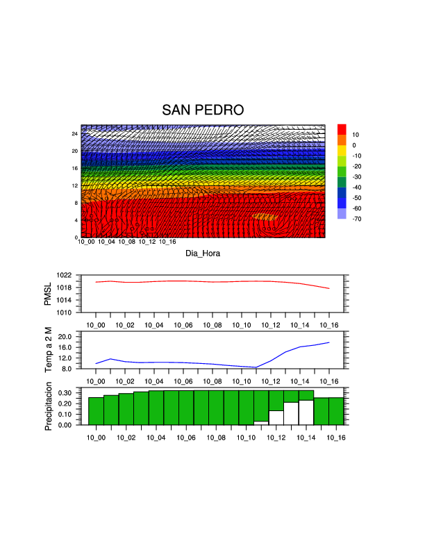
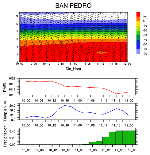
I attach the 2 graphs and my script (I used the same for both, domain and subdomain), I can't attach de nc data because the file is too big.
I hope you can help me out with this.
regards.
Have a nice weekend!!!!
_______________________________________________
ncl-talk mailing list
List instructions, subscriber options, unsubscribe:
http://mailman.ucar.edu/mailman/listinfo/ncl-talk