Date: Mon May 07 2012 - 17:53:41 MDT
Hi,
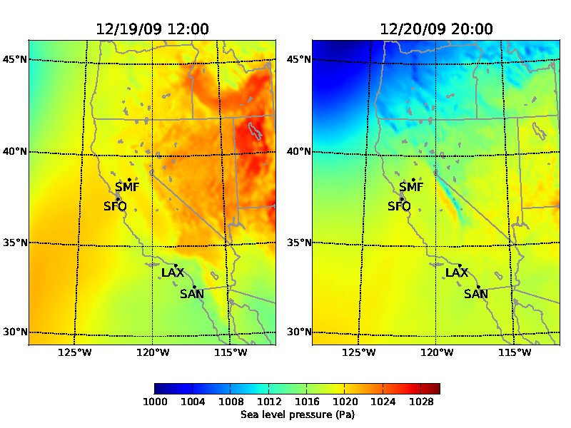
I'm using wrf_slp to compute sea-level pressure.
My supervisors are wondering if it 's normal that we still see the topography at the border between California and Nevada in my plots (see attachment). Another person also posted in wrf-forum about it:"But when I plot the MSLP, I noted that for a pixel above 100m, the correction does'nt work fine. Topography is already affect the pressure. What's the solution? Who had has already encountered this problem? How to solve that?"
I tried to understand the code but I'm still not sure of what exactly it is doing, especially the part with the calculation of T_atPconst and Z_atPconst.
Thanks for your help,
Camille
Dr Camille Yver
Scripps Institution of Oceanography, UC San Diego
9500 Gilman Drive
La Jolla, CA 92093 - 0244
(858)534-7094
_______________________________________________
ncl-talk mailing list
List instructions, subscriber options, unsubscribe:
http://mailman.ucar.edu/mailman/listinfo/ncl-talk