Date: Wed Nov 14 2012 - 01:46:16 MST
Dear sir or madam:
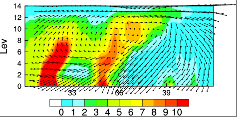
Below is a photo of wind field. The vertical coordinates represents the level of height and the horizontal represents the northern latitude . how can I reduce the density of wind field use wmsetp?
and control the wind in the plot frame ?
_______________________________________________
ncl-talk mailing list
List instructions, subscriber options, unsubscribe:
http://mailman.ucar.edu/mailman/listinfo/ncl-talk