Hi Don,
Actually this was an intentional change that is intended to be permanent. I'm sorry that I forgot about it; it should (and will) be listed under backwards-incompatible changes in
the release notes. Plus it needs to be documented more fully.
This change had to be made in order to eliminate ambiguity about which direction to take between 2 points on the globe. Now the rule is simple: always take the shortest path.
If the distance is exactly 180 degrees in longitude, then go in the direction of the lowest longitude value to the highest where longitude can vary from -540 to + 540.
Unfortunately, this means that the simple specification of a polyline with constant latitude and 0 - 360 longitude produces a 0-length line. Hopefully, adding some extra points to ensure that
the shortest path is un-ambiguous should not be a major chore in general.
Before this change, situations were arising where it was not possible (for me at least) to figure out programmatically which direction a line should take. Now it is much easier. For users as well.
For instance, the case that arose with your colleague Cathy Smith of drawing trajectories that cross the prime meridian should now be much easier to code -- and I am pretty sure the existing more
complicated code will continue to work as well.
Apologies for not making a more prominent statement about this issue along with the release.
-dave
On Apr 15, 2014, at 10:05 AM, Don Murray <don.murray@noaa.gov> wrote:
> Glad it's not me. ;-) Thanks for the workaround, I'll use that until
> 6.2.1 comes out.
>
> Don
>
> On 4/15/14 9:56 AM, Mary Haley wrote:
>> Hi Don,
>>
>> I was able to reproduce your problem and have filed a critical ticket on
>> it (NCL-1943).
>>
>> The only work-around I can come up with is to draw the line in two
>> separate pieces:
>>
>> equa1 = gsn_add_polyline(wks,plot,(/-180,0/),(/0,0/),resp)
>> equa2 = gsn_add_polyline(wks,plot,(/0,180/),(/0,0/),resp)
>>
>> We will likely release a V6.2.1 to fix some bugs in V6.2.0, and this
>> will be high on the list.
>>
>> —Mary
>>
>> On Apr 15, 2014, at 9:07 AM, Don Murray (NOAA Affiliate)
>> <don.murray@noaa.gov <mailto:don.murray@noaa.gov>> wrote:
>>
>>> Hi-
>>>
>>> I have a script that has been running fine under NCL 6.1.2, but now is
>>> not acting the same under 6.2.0. The part that isn't working is drawing
>>> a polyline along the equator. The relevant code is:
>>>
>>> plot = gsn_csm_contour_map(wks,data,rescf) ; color-filled
>>> if (.not.isanom) then
>>> plot1 = gsn_csm_contour(wks,data,rescn) ; contours
>>> overlay(plot,plot1)
>>> end if
>>> dlin = gsn_add_polyline(wks,plot,(/180,180/),(/-90,90/),resp) ; dateline
>>> equa = gsn_add_polyline(wks,plot,(/0,360/),(/0,0/),resp) ; equator
>>> draw(plot)
>>> draw(lbid)
>>> gsn_text_ndc(wks,"NOAA/ESRL/PSD",0.088,0.190,restx)
>>> if (isanom) then
>>> gsn_text_ndc(wks,"Base Period: "+baseDateString,0.52,0.190,restxa)
>>> end if
>>> frame(wks)
>>>
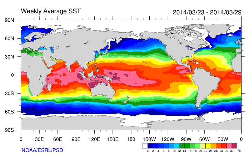
>>> In this script, a line is drawn at the dateline and the equator:
>>>
>>> http://www.esrl.noaa.gov/psd/map/images/sst/sst.20140316.gif
>>>
>>> Since upgrading to NCL 6.2.0, the equator line is missing:
>>>
>>> http://www.esrl.noaa.gov/psd/map/images/sst/sst.20140323.gif
>>>
>>> If I print out the data summary, it looks like:
>>>
>>> Variable: data (parameter)
>>> Type: float
>>> Total Size: 259200 bytes
>>> 64800 values
>>> Number of Dimensions: 2
>>> Dimensions and sizes:[lat | 180] x [lon | 360]
>>> Coordinates:
>>> lat: [89.5..-89.5]
>>> lon: [0.5..359.5]
>>> Number Of Attributes: 18
>>> time :78257
>>> long_name :Weekly Mean of Sea Surface Temperature
>>> unpacked_valid_range :( -5, 40 )
>>> actual_range :( -1.8, 35.63 )
>>> units :degC
>>> missing_value_original :32767
>>> precision :2
>>> least_significant_digit :2
>>> var_desc :Sea Surface Temperature
>>> dataset :NOAA Optimum Interpolation (OI) SST V2
>>> level_desc :Surface
>>> statistic :Weekly Mean
>>> parent_stat :Individual obs
>>> standard_name :sea_surface_temperature
>>> _FillValue_original :32767
>>> _FillValue :32767
>>> valid_range :( -5, 40 )
>>> missing_value :32767
>>>
>>>
>>> I tried adjusting the x values to be (/1,359/), but still no line across
>>> the plot.
>>>
>>> Thoughts on what could be going wrong?
>>>
>>> Don
>>> --
>>> Don Murray
>>> NOAA/ESRL/PSD and CU-CIRES
>>> 303-497-3596
>>> http://www.esrl.noaa.gov/psd/people/don.murray/
>>> _______________________________________________
>>> ncl-talk mailing list
>>> List instructions, subscriber options, unsubscribe:
>>> http://mailman.ucar.edu/mailman/listinfo/ncl-talk
>>
>
> --
> Don Murray
> NOAA/ESRL/PSD and CIRES
> 303-497-3596
> http://www.esrl.noaa.gov/psd/people/don.murray/
> _______________________________________________
> ncl-talk mailing list
> List instructions, subscriber options, unsubscribe:
> http://mailman.ucar.edu/mailman/listinfo/ncl-talk
_______________________________________________
ncl-talk mailing list
List instructions, subscriber options, unsubscribe:
http://mailman.ucar.edu/mailman/listinfo/ncl-talk
Received on Tue Apr 15 18:00:37 2014
This archive was generated by hypermail 2.1.8 : Wed Apr 16 2014 - 09:14:14 MDT