Date: Thu, 16 Nov 2006 16:04:05 +0000
Hello,
I have an issue with mapping a 1/12 degree sst data set. Due to the size of
the file, I get memory problem allocation errors when I graph. So, I cut
the data to only the area I'm using. For some reason the longitude's dont
seem to be translating correctly.
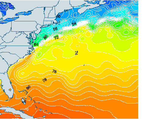
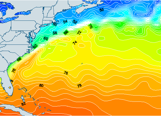
I have attached 2 png maps, one of the 1/12 degree map and one of a
different sst data set of 1/2 degree resolution. An obvious thing to notice
is that the gulf stream is shifted to the left, and the width of the map is
shorter (even tho the lon/lat's are the same).
At first I wasn't sure if this was a data problem or graphing problem, but
it seems more likely the later. Any clues on this one? I'll be happy to
send ncl and data files if desired?
Thank you.
Micah
_______________________________________________
ncl-talk mailing list
ncl-talk_at_ucar.edu
http://mailman.ucar.edu/mailman/listinfo/ncl-talk