That's right. If you are using the xxxx_to_SCRIP or unstructured_to_ESMF functions, it doesn't care whether this is the source or destination
grid, so in this case, you just use "Mask2D" and not "SrcMask2D" or "DstMask2D".
It's when you use ESMF_regrid that you need to specify SrcMask2D and/or DstMask2D, because this function is dealing with both source and destination grids, and hence it needs to know which mask to apply to which grid.
--Mary
On Apr 25, 2013, at 5:21 PM, Bridget Thrasher wrote:
> Adding the Mask2D option fixed the problem for me. I am using the 4-step process (curvilinear_to_SCRIP, rectilinear_to_SCRIP, ESMF_regrid_gen_weights, and ESMF_regrid_with_weights), so for the first step of generating the curvilinear file with masking, I did the following:
>
> ncl 0> f=addfile("prcp/prcp.1980.1.nc","r")
> ncl 1> load "$NCARG_ROOT/lib/ncarg/nclscripts/csm/contributed.ncl"
> ncl 2> load "$NCARG_ROOT/lib/ncarg/nclscripts/esmf/ESMF_regridding.ncl"
> ncl 3> opt=True
> ncl 4> opt@Mask2D = where(.not.ismissing(f->prcp(0,:,:)),1,0)
> ncl 5> curvilinear_to_SCRIP("curv_SCRIP.nc",f->lat,f->lon,opt)
>
> Hope that helps!
>
> -Bridget
>
>
> Date: Fri, 12 Apr 2013 18:06:32 -0600
> From: Mary Haley <haley@ucar.edu>
> Subject: Re: Edge issue in Regridding Daymet Joined Tiles
> with ESMF_Regridding on NCL 6.1.0
> To: Dave Allured - NOAA Affiliate <dave.allured@noaa.gov>
> Cc: ncl-talk@ucar.edu, esmf_support Support
> <esmf_support@list.woc.noaa.gov>
> Message-ID: <A0538EE3-0438-439C-8A0B-EFBF7791D0A5@ucar.edu>
> Content-Type: text/plain; charset=us-ascii
>
>
> I don't have the original script in front me, but sometimes you need to
> set the special SrcMask2D array to an array of 0s and 1s, where
> 1 represents a "good" value, and 0 represents a bad or missing value.
>
> I'm having to do this now in an EASE grid that has missing values
> in the 2D lat/lon arrays, but I've also had to do it for arrays that
> have missing values in their data arrays.
>
> I will try this with the ESMF_all_1.ncl script to see if it makes a difference.
>
> --Mary
>
>
> On Apr 12, 2013, at 4:58 PM, Dave Allured - NOAA Affiliate wrote:
>
>> Ping's example is fairly dramatic, but I think I have seen this
>> bathtub ring effect in other cases:
>>
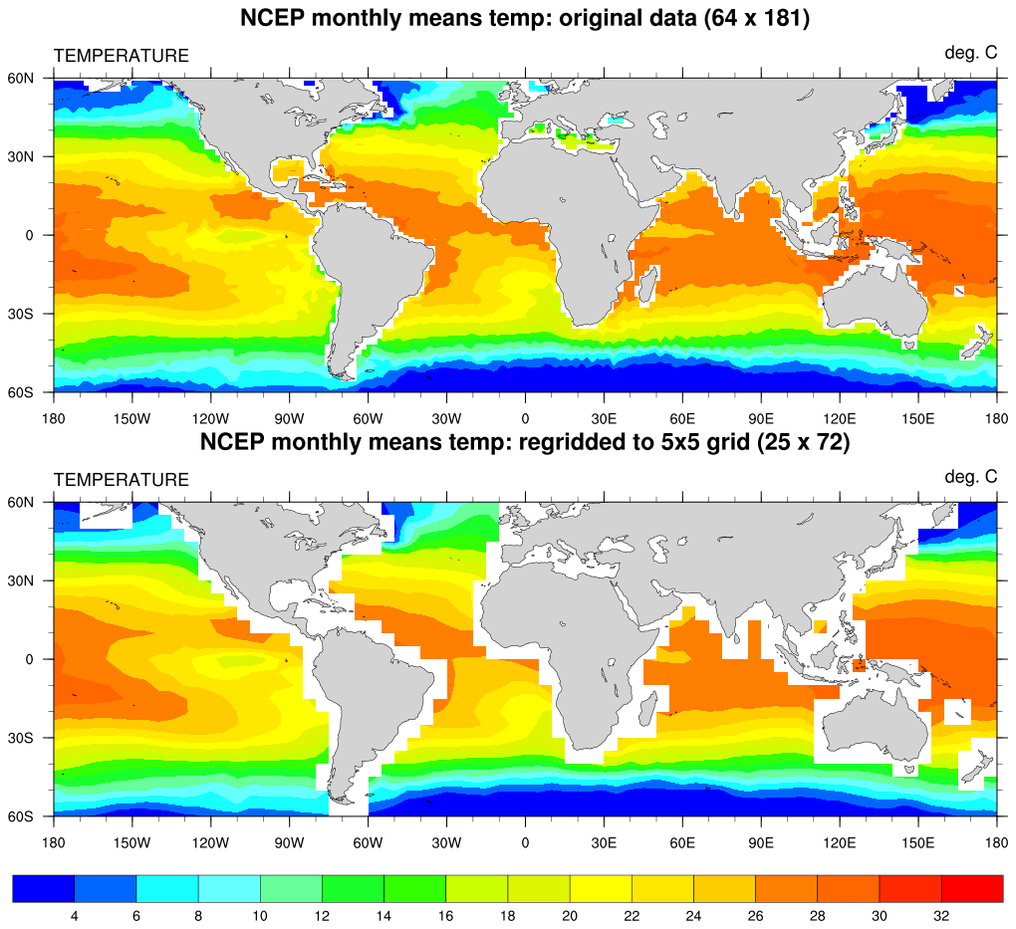
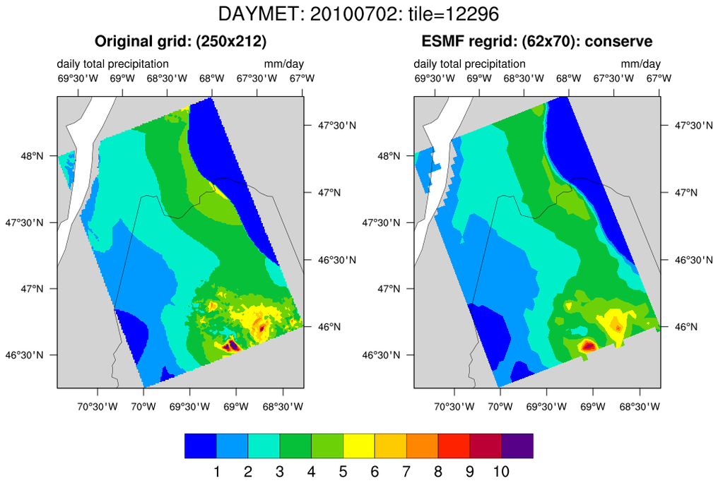
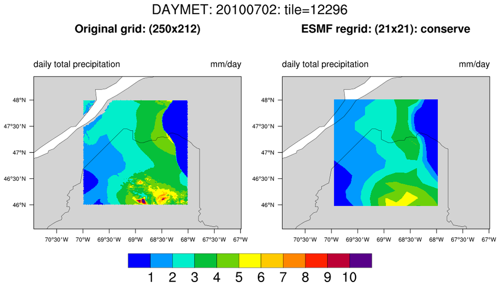
>> http://www.ncl.ucar.edu/Applications/Images/ESMF_all_1_lg.png
>> http://www.ncl.ucar.edu/Applications/Images/daymet_2_lg.png
>> http://www.ncl.ucar.edu/Applications/Images/daymet_3_lg.png
>>
>> All cases use ESMF regridding, and all cases display an unexpected
>> bias toward zero along the interface between data and missing values.
>> Something NOT in common is the conserve method; ESMF_all_1 uses ESMF
>> bilinear.
>>
>> I do not have a solution, but please look for the possibility that
>> input missing values are being interpreted as zeros in the core regrid
>> calculation. You would get the same problem if missing values are
>> accidentally being counted in the divisor, when computing the local
>> area average for each output grid point. HTH.
>>
>> --Dave
>>
>> On Fri, Apr 12, 2013 at 4:12 PM, Mary Haley <haley@ucar.edu> wrote:
>>> Hi Ping,
>>>
>>> If you have the three *.nc files that are created by ESMF_regrid, then the ESMF folks might be able to look at them to see if there's an issue with the conserve method.
>>> They would also need to see exactly how ESMF_RegridWeightGen is being called, which you can see if you set:
>>>
>>> Opt@Debug = True
>>>
>>> Or, if you can provide me with your two input data files, then I can narrow down the script so that it only does one timestamp, and I will send the info off to the ESMF folks.
>>>
>>> http://www.ncl.ucar.edu/report_bug.shtml#HowToFTP
>>>
>>> --Mary
>>>
>>>
>>> On Apr 12, 2013, at 3:19 PM, Ping Yang wrote:
>>>
>>>> Dear NCL,
>>>>
>>>> I was using the following script to regridding the joined Daymet grid (1 KM) to 3 acrmin, in which the projection was translated from LLC to lonlat and the resolution from 1 KM to 3 arcmin. However, after I tried to comparing different interpolation method based on the 3 arcmin data (I used a conserve method for the ESMF regridding), I found the this 3 arcmin data has problem in the edge/boundary.
>>>>
>>>> I am including a graphs here to show the problem:
>>>> <image.png>
>>>> The edge(coast and land) place especially in Maine (also massachusetts) looks weird after the regridding, a mixture of no data value and real values, and when I do a statistical of year sum, I got very small values(below 10 mm) for one year.
>>>>
>>>> The script I was using is:
>>>>
>>>> load "$NCARG_ROOT/lib/ncarg/nclscripts/csm/gsn_code.ncl"
>>>> load "$NCARG_ROOT/lib/ncarg/nclscripts/csm/gsn_csm.ncl"
>>>> load "$NCARG_ROOT/lib/ncarg/nclscripts/wrf/WRFUserARW.ncl"
>>>> load "$NCARG_ROOT/lib/ncarg/nclscripts/esmf/ESMF_regridding.ncl"
>>>> vname ="pr"
>>>> srcFileName = vname + ".NE." + year +".nc"
>>>> ;srcFileName = "NE_all_1980_correct_prcp.nc"
>>>> srcPathName = srcDirName+srcFileName
>>>> sfile = addfile(srcPathName,"r")
>>>>
>>>> ;---Set the destination file name
>>>> dstDirName = "/data/ecr/yangping/DAYMET/Grid/Intermediate/"
>>>> system("/bin/mkdir -p "+ dstDirName)
>>>> dstFileName = str_upper(vname)+"."+year+"_1KM.esmf.nc"
>>>> dstPathName = dstDirName+dstFileName
>>>>
>>>> setfileoption("nc","Format","LargeFile")
>>>>
>>>> ;out=addfile("/data/ecr/yangping/DAYMET/Grid/3MIN/" + vname + "_3MIN_lonlat_" + year+".nc","c")
>>>> outDirName = "/data/ecr/yangping/DAYMET/Grid/3MIN/"
>>>> outFileName = vname + ".3MIN.lonlat." + year+".nc"
>>>> outPathName = outDirName + outFileName
>>>> system("/bin/rm -f "+outPathName) ; delete any pre-existing file
>>>> out=addfile(outPathName,"c")
>>>>
>>>> ;--- ESMF regrid method: "conserve", "bilinear", "patch"
>>>> method = "conserve"
>>>> ; method = "patch"
>>>>
>>>> ;===================================================
>>>>
>>>> ;---Options
>>>> Opt = True
>>>> Opt@SrcTitle = "Daymet Joined Grid "+year+" to rectlinear" ; optional
>>>> Opt@WgtFileName = dstDirName + "Daymet_to_Rect.Wgt.nc"
>>>>
>>>> Opt@ForceOverwrite = True
>>>> ;;Opt@PrintTimings = True
>>>>
>>>> ;---Get the source file Daymet lat/lon grid
>>>> lat2d = sfile->lat
>>>> lon2d = sfile->lon
>>>>
>>>> dim2d = dimsizes(lat2d)
>>>> nlat = dim2d(0)
>>>> nlon = dim2d(1)
>>>>
>>>> print(nlat)
>>>> print(nlon)
>>>>
>>>> ;---Get the Daymet source variable
>>>> var = sfile->$vname$ ; (time, y, x)=>(365,232,221)
>>>>
>>>> ;Opt@SrcGridType = "curvilinear"
>>>> Opt@SrcGridLat = lat2d
>>>> Opt@SrcGridLon = lon2d
>>>>
>>>> ;---Create the destination lat/lon grid
>>>> dll=0.05 ;3MIN
>>>> latrange=abs(max(lat2d)-min(lat2d))
>>>> lonrange=abs(max(lon2d)-min(lon2d))
>>>> kpts_lat= toint(latrange/dll)+1
>>>> kpts_lon= toint(lonrange/dll)+1
>>>> lat = fspan( min(lat2d),max(lat2d), kpts_lat )
>>>> lon = fspan( min(lon2d),max(lon2d), kpts_lon )
>>>>
>>>> newlon = fspan(-84.025,-64.875,384)
>>>> newlat = fspan(34.875,50.125,306)
>>>>
>>>> Opt@DstGridType = "rectilinear"
>>>> ;Opt@DstGridLat = lat
>>>> Opt@DstGridLat = newlat
>>>> ;Opt@DstGridLon = lon
>>>> Opt@DstGridLon = newlon
>>>>
>>>> Opt@CopyVarCoords= True ; default for 6.1.0
>>>>
>>>> Opt@InterpMethod = method
>>>> Opt@SrcRegional = True
>>>> Opt@DstRegional = True
>>>>
>>>> var_regrid = ESMF_regrid(var,Opt) ; Do the regridding for 'var'
>>>> printVarSummary(var_regrid)
>>>> var_regrid@grid_mapping = "lonlat" ;
>>>> out->$vname$=var_regrid ;output the regridding result
>>>>
>>>> Can some here where is the problem and how to fix it?
>>>>
>>>> Look forward to hearing from you.
>>>>
>>>> Regards,
>>>>
>>>> Ping
>
>>>
> _______________________________________________
> ncl-talk mailing list
> List instructions, subscriber options, unsubscribe:
> http://mailman.ucar.edu/mailman/listinfo/ncl-talk
_______________________________________________
ncl-talk mailing list
List instructions, subscriber options, unsubscribe:
http://mailman.ucar.edu/mailman/listinfo/ncl-talk
Received on Fri Apr 26 15:33:55 2013
This archive was generated by hypermail 2.1.8 : Fri Apr 26 2013 - 17:10:25 MDT