Date: Mon Jul 15 2013 - 02:20:24 MDT
Dear all,
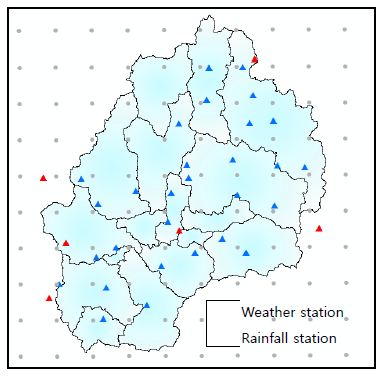
I would like to extract temperature and Precipitation data from the HADGEM3
RCM for my weather and rainfall station as shown in figure. How can i overlap
my shape file and RCM data and extract the nearest grid data. How can I
show the grid point with data available from RCM as shown in below figure.
I would be very thankful if you provide me the sequential steps to do this.
Regards
Ja
[image: Inline image 1]
_______________________________________________
ncl-talk mailing list
List instructions, subscriber options, unsubscribe:
http://mailman.ucar.edu/mailman/listinfo/ncl-talk