Hi NCL Talk,
I have what is hopefully a simple problem. I've been making a simple black
and white map with tropical cyclone tracks overlaid (with a text box
located to the upper right of the track highlighting the system's name).
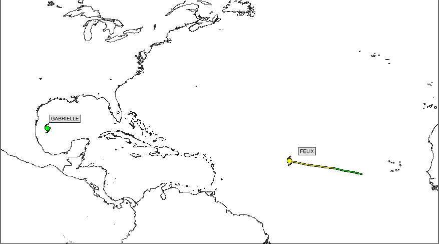
Occasionally this textbox appears on the edge of the map domain and
overlaps with the map viewport, creating an image that looks like this:
http://www.atmos.albany.edu/student/ppapin/lb13_img/html/gridsat_grid/ibtracs_trans_atl_73.png
Instead of the remainder of the text showing up outside of the map, I'd
like it to be buried underneath without any visible information outside of
the map domain. In its current configuration it makes the horizontal size
of the image larger than it needs to be (note the differences between the
text outside of the
map<http://www.atmos.albany.edu/student/ppapin/lb13_img/html/gridsat_grid/ibtracs_trans_atl_73.png>vs.
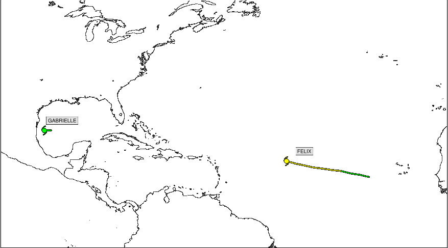
text
only inside of the
map<http://www.atmos.albany.edu/student/ppapin/lb13_img/html/gridsat_grid/ibtracs_trans_atl_75.png>
).
Is this possibly a viewport issue? I am using *gsn_add_text* to write text
to the map domain. I would be happy to provide additional code if necessary
to figure out what is going on.
Thanks,
Philippe
--
-------------------------------------
Philippe P. Papin
Dept. of Atmospheric and Environmental Sciences
University at Albany, SUNY
1400 Washington Ave, Albany, NY 12222
http://www.atmos.albany.edu/student/ppapin/
_______________________________________________
ncl-talk mailing list
List instructions, subscriber options, unsubscribe:
http://mailman.ucar.edu/mailman/listinfo/ncl-talk
Received on Sun Jan 05 21:31:11 2014
This archive was generated by hypermail 2.1.8 : Mon Jan 06 2014 - 13:09:53 MST