Date: Tue Jan 25 2011 - 11:20:49 MST
Howdy all, I have a set of data to store in a PostGIS database and to
use to create images. I've looked at a bathymetry example which I
grabbed from www.arsc.eu/~kate/grids/grid_cdf.ncl as well as the
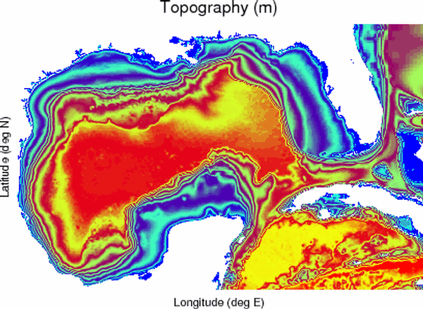
native_5.ncl example on the NCL web site. I have attached a sample
topography.gif and its associated topography.nc (separate from the
ias_2010060112.nc file which is 37Mb).
Now, I'm rusty with my ncl and could use some help and/or pointers. I'm
sure someone has already worked with data like this. I'm stuck on the
lines in the example native_5.ncl script which are:
file1 = addfile(FILENAME1,"r")
field1 = file1->$FIELDNAME1$(TIME1,::-1,:)
A summary of this data looks like this:
filename: ias_2010060112.nc
variable type dimension long_name units
--------------------------------------------------------------
Time integer 1D Elapse Time hour
(Notes: start 2010-06-01 00:00:00 FORM YYYY-MM-DD hh:mm:ss)
Longitude float 1D Longitude deg E
Latitude float 1D Latitude deg N
Depth float 1D Depth m
Elevation float 3D Surface Elevation m
dimensions: Time, Latitude, Longitude
Temperature float 4D Potential Temperature deg C
dimensions: Time, Depth, Latitude, Longitude
Salinity float 4D Salinity ppt
dimensions: Time, Depth, Latitude, Longitude
U-Velocity float 4D U-component Velocity m/s
dimensions: Time, Depth, Latitude, Longitude
V-Velocity float 4D V-component Velocity m/s
dimensions: Time, Depth, Latitude, Longitude
Bottom_U-Velcity float 3D U-Velocity 100m above bottom m/s
dimensions: Time, Latitude, Longitude
Bottom_V-Velcity float 3D V-Velocity 100m above bottom m/s
dimensions: Time, Latitude, Longitude
MLD float 3D Surface Mixed-Layer Depth m
dimensions: Time, Latitude, Longitude
I have a filedump here:
$ ncl_filedump nrl_iasnfs_2010060112.nc
Copyright (C) 1995-2009 - All Rights Reserved
University Corporation for Atmospheric Research
NCAR Command Language Version 5.1.1
The use of this software is governed by a License Agreement.
See http://www.ncl.ucar.edu/ for more details.
Variable: f (file variable)
filename: nrl_iasnfs_2010060112
path: nrl_iasnfs_2010060112.nc
file global attributes:
source : NRL_IASNFS/Ko
title : GOMEX_Forecast_Daily_Average
dimensions:
Time = 1
Longitude = 401
Latitude = 261
Depth = 22
variables:
integer Time ( Time )
long_name : Elapse Time
units : hour
FORTRAN_format : i8
start : 2010-06-01 00:00:00
FORM : YYYY-MM-DD hh:mm:ss
float Longitude ( Longitude )
long_name : Longitude
units : deg E
FORTRAN_format : f8.3
float Latitude ( Latitude )
long_name : Latitude
units : deg N
FORTRAN_format : f8.3
float Depth ( Depth )
long_name : Depth
units : m
FORTRAN_format : f8.3
float Elevation ( Time, Latitude, Longitude )
long_name : Surface Elevation
units : m
FORTRAN_format : f8.3
_FillValue : -99
float Temperature ( Time, Depth, Latitude, Longitude )
long_name : Potential Temperature
units : deg C
FORTRAN_format : f8.3
_FillValue : -99
float Salinity ( Time, Depth, Latitude, Longitude )
long_name : Salinity
units : ppt
FORTRAN_format : f8.3
_FillValue : -99
float U-Velocity ( Time, Depth, Latitude, Longitude )
long_name : U-component Velocity
units : m/s
FORTRAN_format : f8.3
_FillValue : -99
float V-Velocity ( Time, Depth, Latitude, Longitude )
long_name : V-component Velocity
units : m/s
FORTRAN_format : f8.3
_FillValue : -99
float Bottom_U-Velcity ( Time, Latitude, Longitude )
long_name : U-Velocity 100m above bottom
units : m/s
FORTRAN_format : f8.3
_FillValue : -99
float Bottom_V-Velcity ( Time, Latitude, Longitude )
long_name : V-Velocity 100m above bottom
units : m/s
FORTRAN_format : f8.3
_FillValue : -99
float MLD ( Time, Latitude, Longitude )
long_name : Surface Mixed-Layer Depth
units : m
FORTRAN_format : f8.1
_FillValue : -99
$
_______________________________________________
ncl-talk mailing list
List instructions, subscriber options, unsubscribe:
http://mailman.ucar.edu/mailman/listinfo/ncl-talk
- application/octet-stream attachment: ias_topography.nc__x-mac-creator_0__x-mac-type_0