I'm looking for a little help on analyzing a 5 month time-series of AVHRR
satellite sea surface data in hopes of learning a little about upwelling
patterns along the coast of the Mid-Atlantic Bight. Ocean water upwelling
occurs periodically near the coast of continents when the winds are
favorable and cause water from near the coast to pile up offshore. When
this occurs, cold, nutrient rich water is upwelled from the depths to
replace the warm water that was advected offshore.
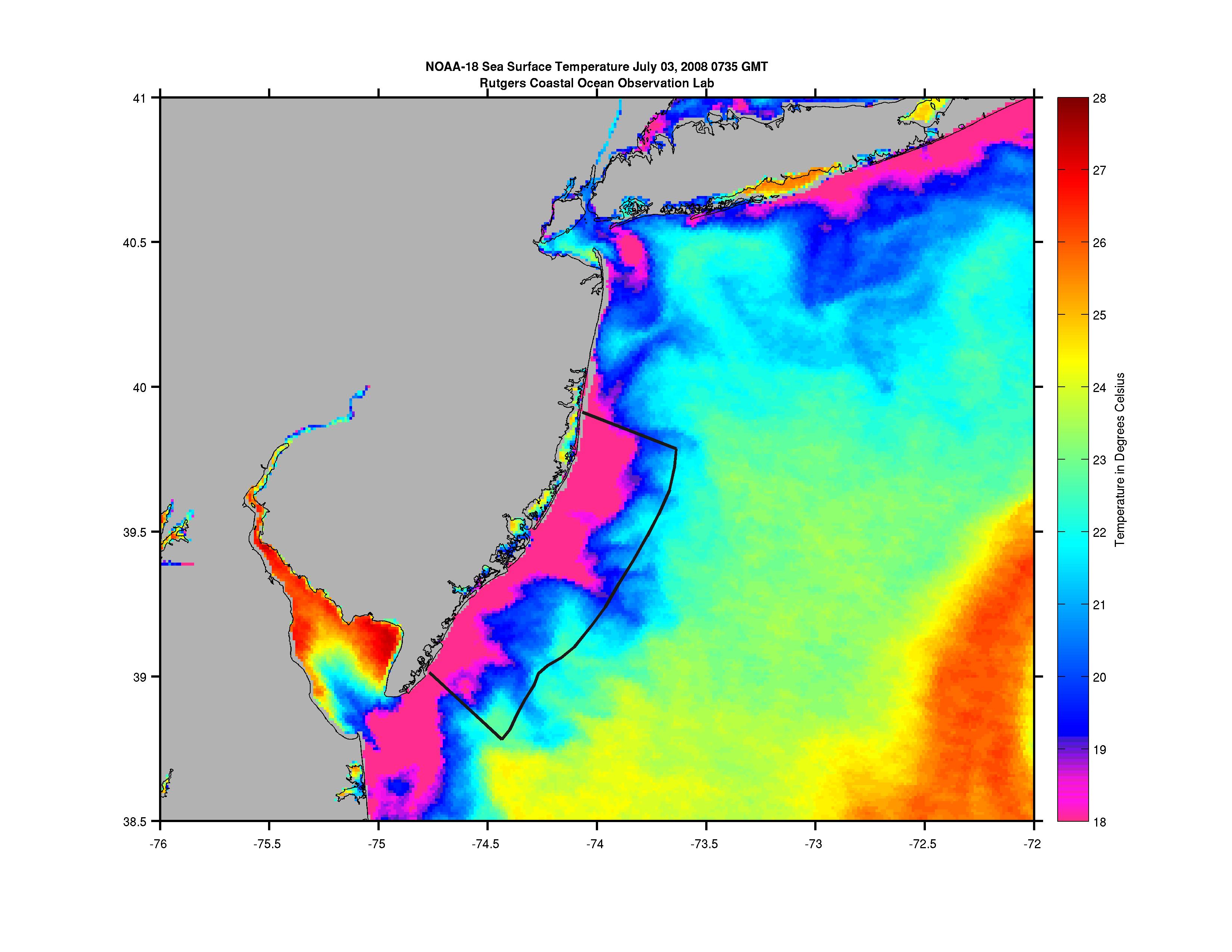
So the primary signal I'm looking for is colder than average temperatures
along the coast in the summer time. Here's an
example<http://marine.rutgers.edu/%7Ekerfoot/pub/sat/080703upw-v2.jpg>
.
I've spent a little time looking over the NCL climatology
functions,<http://www.ncl.ucar.edu/Document/Functions/climo.shtml>but
am a little overwhelmed by them all. I think I need to compare daily
or
monthly climatologies to daily composites an look for low temperature
anomalies, but I'd like to get a computer to do it for me. The dataset
consists of individual satellite passes (we get anywhere from 4 - 8 per
day).
Any suggestions on where to begin?
Thanks in advance for any advice.
John
_______________________________________________
ncl-talk mailing list
List instructions, subscriber options, unsubscribe:
http://mailman.ucar.edu/mailman/listinfo/ncl-talk
Received on Wed May 18 06:46:26 2011
This archive was generated by hypermail 2.1.8 : Thu Jun 09 2011 - 14:56:48 MDT