Date: Wed Mar 28 2012 - 14:53:00 MDT
Hi Mary,
Are you saying RasterFill doesnot work in this case?
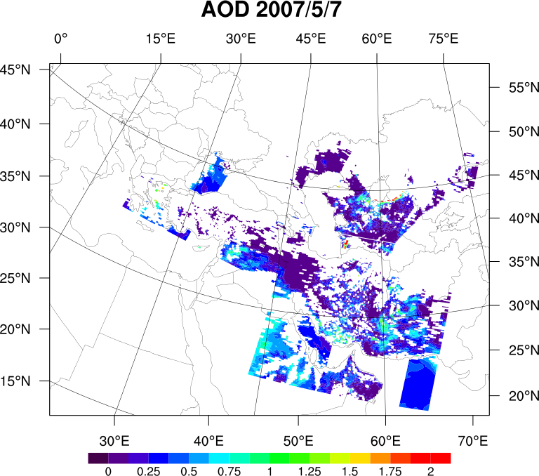
I followed your advice on setting the cnMinlevel and cnMaxlevel. The plot
with cell fill comes out funny (see attached) - I donot know why. By not
looking good, I meant, the plot looks wiggling and has the white edges of
each cell.
I intensionally set the lat/lon limits to show the domain I am interested
at.
Thanks!
Xin
On Wed, Mar 28, 2012 at 4:29 PM, Mary Haley <haley@ucar.edu> wrote:
>
>
> Dear Xin,
>
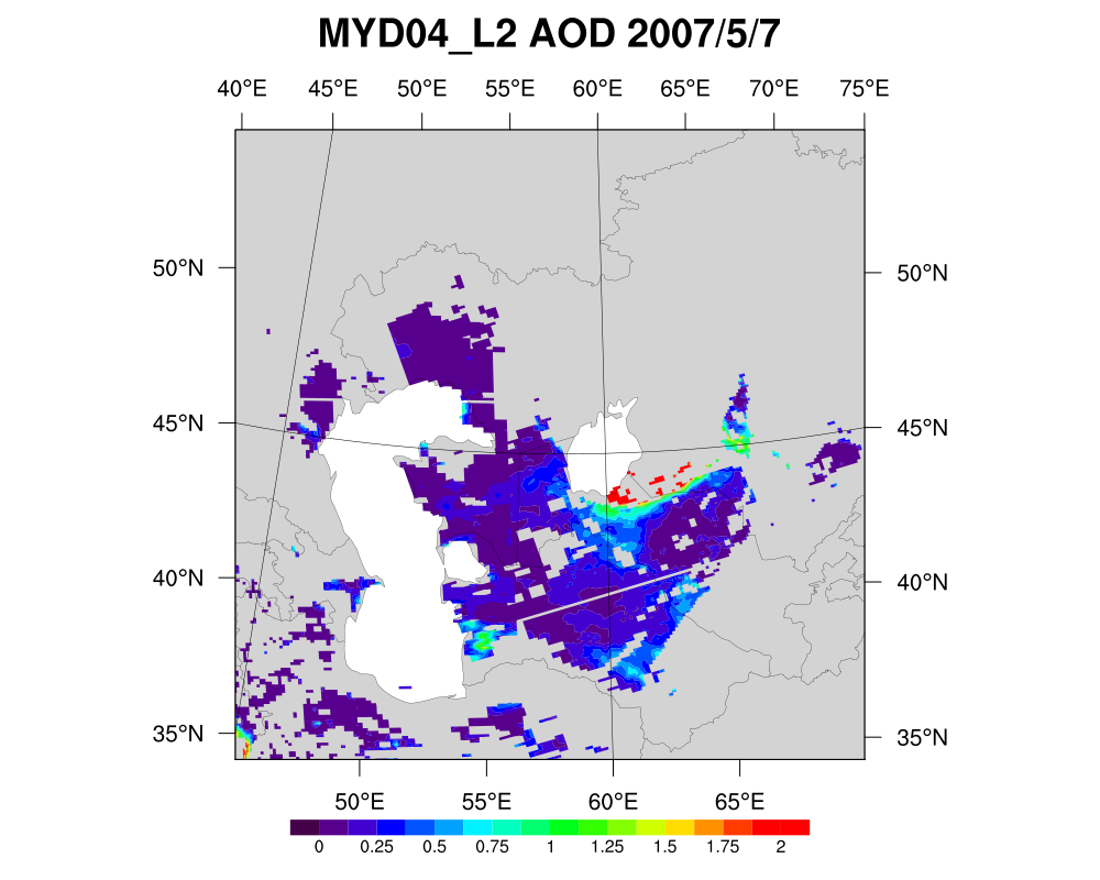
> What's happening with the raster fill is that you have some areas with no
> data, which get filled in with white, because you can't have transparency
> in a raster plot. You will need to use CellFill in order to get the
> transparency and still be able to see all the overlaid contours. I will
> update the example on the HDF page to reflect this issue.
>
> Can you explain what you mean by the CellFill not looking good?
>
> One word of caution: whenever you are comparing several contour plots and
> using one labelbar to represent them all, you need to make sure that you
> set the contour levels to the same range for every plot. If you don't do
> this, NCL is going to pick "nice" contour levels for each plot you create,
> and the levels may be different from one plot to the next, if your data
> range changes.
>
> To fix this, I added the following resources to your script:
>
> res@cnLevelSelectionMode = "ManualLevels"
> res@cnMinLevelValF = 0.0
> res@cnMaxLevelValF = 2.0
> res@cnLevelSpacingF = 0.125
>
> Also, I don't know if this was intentional, but the min/max range you
> chose for the map (via mpMin/MaxLat/LonF) is not big enough to cover the
> full range of your actual lat2d/lon2d arrays.
>
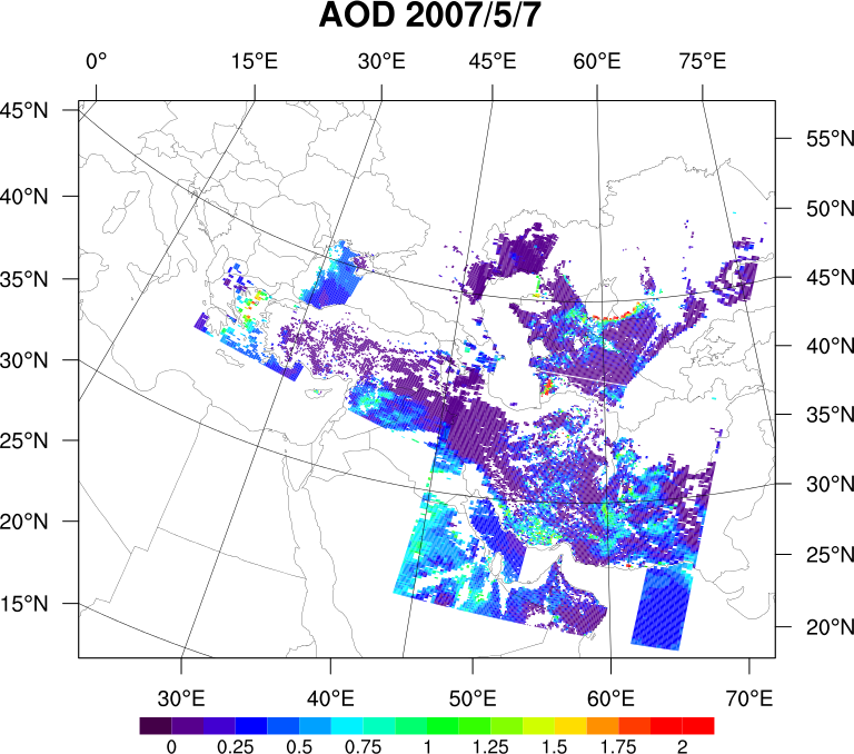
> I've attached a version of your plot that was draw with the default
> AreaFill versus CellFill so you can compare.
> --Mary
>
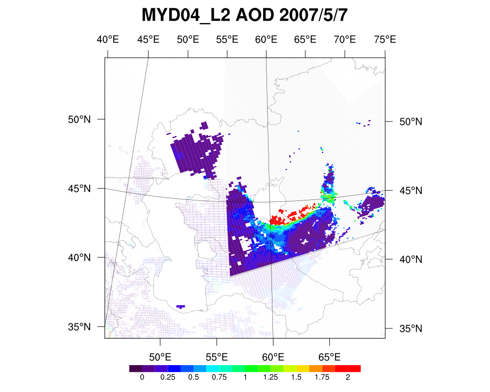
> Hello,
> I am making a plot following example of
> http://www.ncl.ucar.edu/Applications/Images/hdf4sds_5_lg.png. In the
> example script, the cnFillMode is mistakenly (since the comment reads
> "Raster Mode" and other rasterfill options are used) set to CellFill. In my
> script, when I set cnFillMode to RasterFill, but it gives me a blank map;
> interestingly, while I set it to CellFill, it gives me the aerosol optical
> depth, but the way CellFill does it doesnot look good. Please help out on
> this RasterFill vs. CellFill problem. Thanks!
> I have attached my script and data.
>
> Xin
> <script.ncl><data.zip>
>
>
>
>
>
>
>
--
*Xin Xi
School of Earth and Atmospheric Sciences
Georgia Institute of Technology
311 Ferst Drive, Atlanta, GA 30332-0340*