Hi Xiaoming,
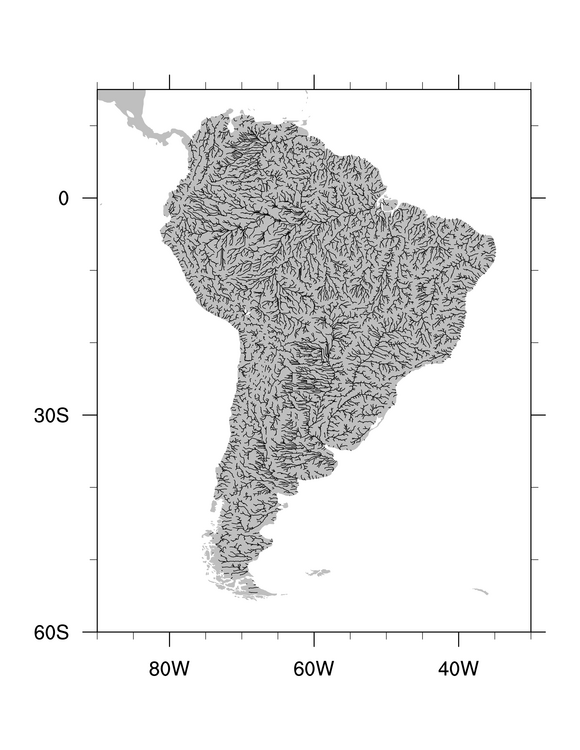
If you have version 5.1.1 of NCL, then you can download the shapefile
data file that's provided in the URL, and use the attached script
"SouthAmerica.ncl" to plot the data, Please see the PNG image as well.
There are over 8000 individual line segments being "added" to the map,
which can be a bit time-consuming. If you don't need to resize your
plot (like to panel it), then it will be faster to use "gsn_polyline"
rather than "gsn_add_polyline". The wall clock time goes from about
50.5 seconds to 8.7 seconds.
See the "SouthAmerica_faster.ncl" script for the faster version.
--Mary
On Sun, 20 Sep 2009, Xiaoming Sun wrote:
>
> Dear Sir or Madam,
>
> Thanks for reading this E-mail!
>
> I am trying to get some river network plotted over South America using
> NCL.
>
> Although there is some data from
> http://edc.usgs.gov/products/elevation/gtopo30/hydro/sa_streams.html
> , it is in GIS format, which I am not familiar with.
>
> I am wondering whether there are any better or more convenient ways to
> get the river network plotted over South America using NCL?
>
> Could you please give some suggestions?
>
> Thanks!
>
> Best Regards,
>
> Xiaoming
>
>
_______________________________________________
ncl-talk mailing list
List instructions, subscriber options, unsubscribe:
http://mailman.ucar.edu/mailman/listinfo/ncl-talk
This archive was generated by hypermail 2.2.0 : Mon Sep 21 2009 - 09:40:03 MDT