Date: Tue May 20 2014 - 07:48:37 MDT
Hello
I am quite new to the ncl toolbox and I would like to ask a thing
concerning the regridding options.
I am using CFSR wind data maps that are taken for global scale and would
like to re-size them into a smaller grid so I can obtain the netCDF
information only for a specified area and use them for wave simulations.
I previously tried with the CDO toolbox as well to re-build the map to
my own preferences but that resulted to a "zeroing" of the coordinates
of the wind files not giving me the correct wind fields to simulate
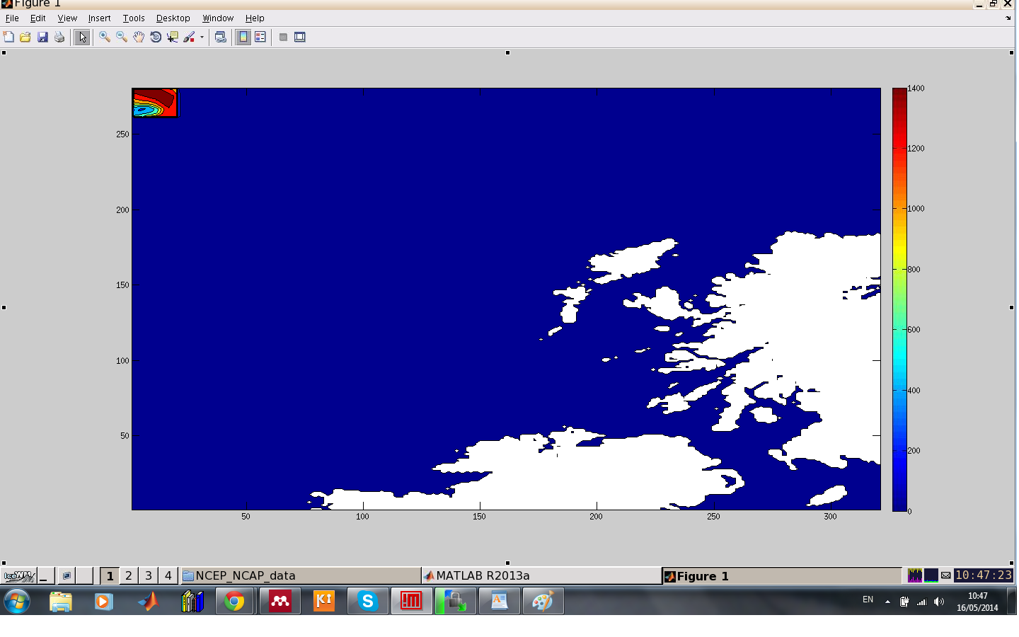
As you can see in the attached picture the actual result i got was far
from the area that wanted the wind components to affect and was limited
only to a small rectangular area on the upper left corner.
I think I can use some of the scripts from the on the ncl page
(https://www.ncl.ucar.edu/Applications/concepts_list.shtml)
But I am confused on the process
My task is to remap the grid into a regular one with resolution 720x361
(or 0.5x0.5 degrees or less) then "trim" the area I want into my desired
shape and by using a python script I have written extract the wind
components so i can insert them to my simulation.
Any advice would be helpful, since I am new to large data manipulation
and extraction.
Thank you very much for your help in advance
George
--
George Lavidas
The University of Edinburgh is a charitable body, registered in
Scotland, with registration number SC005336.
_______________________________________________
ncl-talk mailing list
List instructions, subscriber options, unsubscribe:
http://mailman.ucar.edu/mailman/listinfo/ncl-talk