The data are available as a suite of 2x2 degree tiles. Each tile contains 1km x 1km gridded values and is available as a netCDF file. The tile locations cover land areas from Mexico to southern Canada. Due to the convergence of the meridions, the grid size of each tile can vary.
NCL Home>
Application examples>
Data sets ||
Data files for some examples
 daymet_1.ncl:
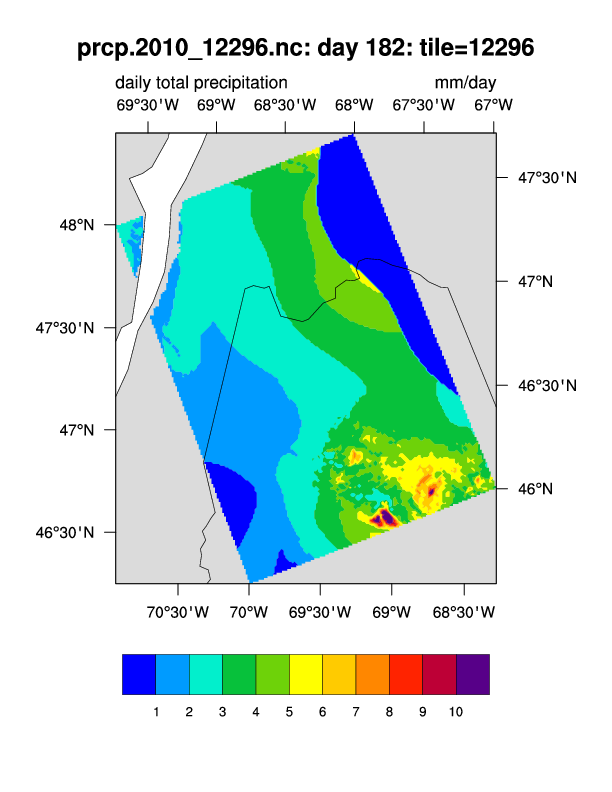
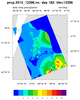
Read a Daymet netCDF file containing an individual 2x2 degree tile and
plot on the native Lambert Conformal projection. The default background
is used. The state of Maine and the St. Lawrence Seaway are clearly visible.
daymet_1.ncl:
Read a Daymet netCDF file containing an individual 2x2 degree tile and
plot on the native Lambert Conformal projection. The default background
is used. The state of Maine and the St. Lawrence Seaway are clearly visible.
 daymet_2.ncl:
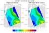
Interpolate data from a high resolution 2x2 degree tile (here, 250x212 containing
1km x 1km values) to a coarser resolution (62x70) rectilinear grid using ESMF
conservative interpolation. The medium resolution map background is used
for the plots.
daymet_2.ncl:
Interpolate data from a high resolution 2x2 degree tile (here, 250x212 containing
1km x 1km values) to a coarser resolution (62x70) rectilinear grid using ESMF
conservative interpolation. The medium resolution map background is used
for the plots.
 daymet_3.ncl:
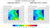
This is a variation of Example 2. The data are plotted on a cylindrical
equidistant background to more clearly illustrate the two degree nature
of the original Daymet 2x2 tile. Also, the data are interpolated to a
relatively crude 0.1x0.1 degree grid (21x21) using conservative interpolation.
daymet_3.ncl:
This is a variation of Example 2. The data are plotted on a cylindrical
equidistant background to more clearly illustrate the two degree nature
of the original Daymet 2x2 tile. Also, the data are interpolated to a
relatively crude 0.1x0.1 degree grid (21x21) using conservative interpolation.
Example pages containing:
tips |
resources |
functions/procedures
NCL: DAYMET: Daily Sfc Weather and Climatologies
Daymet:
Developed by Dr. Peter E Thornton to fulfill the need for daily climatological data necessary for plant growth model inputs, Daymet generates daily, gridded surfaces of temperature, precipitation, humidity, and radiation over large regions and takes into account areas of complex terrain.
The netCDF file used in Examples 1-3 can be downloaded via:
wget --limit-rate=3m http://daymet.ornl.gov/thredds/fileServer/allcf/2010/12296_2010/prcp.nc -O prcp.2010_12296.nc
Dave Allured of the NOAA/PSD/CIRES Climate Analysis Branch posted the following to ncl-talk@ucar.edu.
I am pleased to announce a new version of the NCL join script for spatially merging Daymet NetCDF files. This version should be easier to use and more reliable than before. New features include:
- Multiple tiles can be efficiently joined in a single program run.
- Common grid point between tiles is no longer required.
- Missing 2-D coordinates in gaps between tiles are automatically filled in.
- New diagnostics to ensure correct spatial alignment are included.
- Support for larger output files is improved.
The most significant feature is infill of missing 2-D coordinates. Output from previous versions left zeros in portions of the 2-D coordinates, which made these files very difficult to use with some graphics systems such as NCL. This problem is now completely solved, thanks to a new supplemental coordinate file provided by Daymet/ORNL.
The new join script is identified as join.daymet.1226.ncl. It can be obtained from the updated documentation website: http://www.esrl.noaa.gov/psd/people/dave.allured/data/daymet/daymet.html
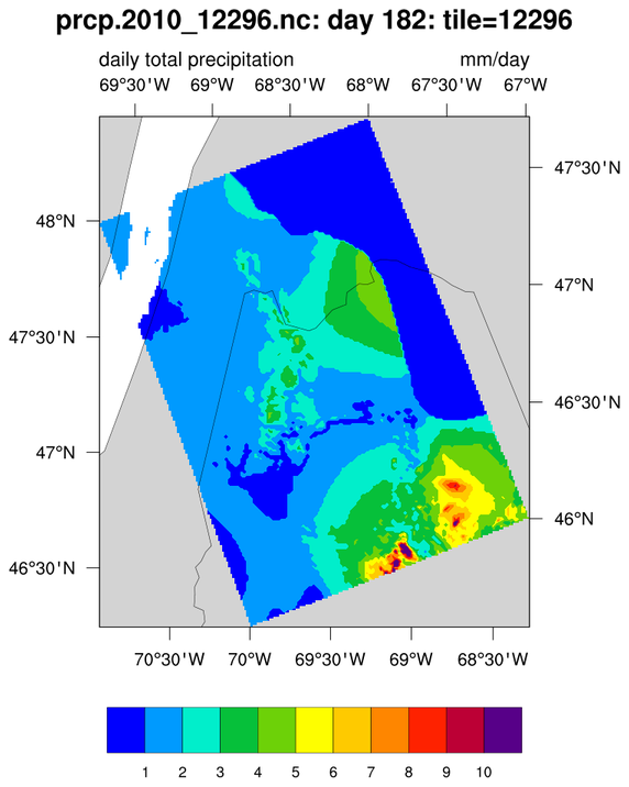 daymet_1.ncl:
Read a Daymet netCDF file containing an individual 2x2 degree tile and
plot on the native Lambert Conformal projection. The default background
is used. The state of Maine and the St. Lawrence Seaway are clearly visible.
daymet_1.ncl:
Read a Daymet netCDF file containing an individual 2x2 degree tile and
plot on the native Lambert Conformal projection. The default background
is used. The state of Maine and the St. Lawrence Seaway are clearly visible.
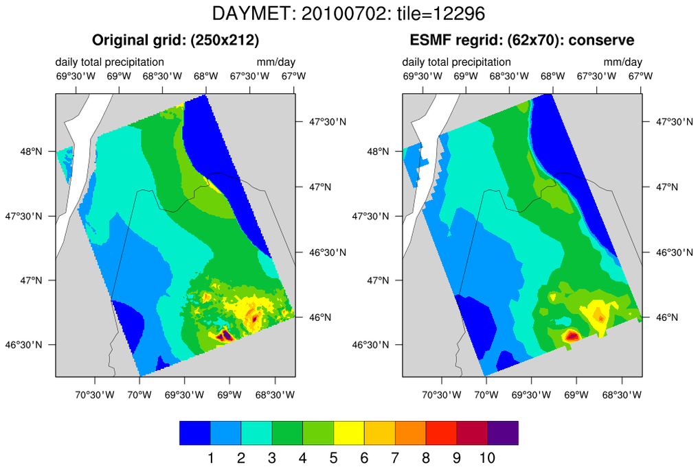 daymet_2.ncl:
Interpolate data from a high resolution 2x2 degree tile (here, 250x212 containing
1km x 1km values) to a coarser resolution (62x70) rectilinear grid using ESMF
conservative interpolation. The medium resolution map background is used
for the plots.
daymet_2.ncl:
Interpolate data from a high resolution 2x2 degree tile (here, 250x212 containing
1km x 1km values) to a coarser resolution (62x70) rectilinear grid using ESMF
conservative interpolation. The medium resolution map background is used
for the plots.
The script produces 4 netCDF files. Three associated with the ESMF regridding software: (i) a weight file which can be used to regrid other variables from the same tile; (ii) a 'SCRIP style' file containing a description of the source (daymet tile) grid; (iii) a 'SCRIP style' file containing a description of the destination rectilinear grid; and, (iv) a file containing the regridded variable.
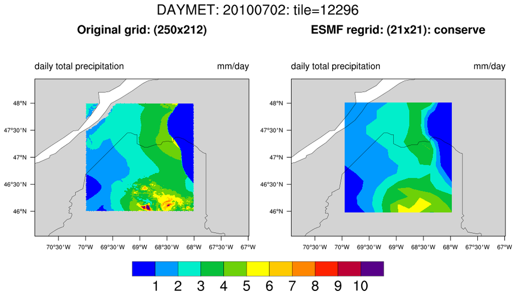 daymet_3.ncl:
This is a variation of Example 2. The data are plotted on a cylindrical
equidistant background to more clearly illustrate the two degree nature
of the original Daymet 2x2 tile. Also, the data are interpolated to a
relatively crude 0.1x0.1 degree grid (21x21) using conservative interpolation.
daymet_3.ncl:
This is a variation of Example 2. The data are plotted on a cylindrical
equidistant background to more clearly illustrate the two degree nature
of the original Daymet 2x2 tile. Also, the data are interpolated to a
relatively crude 0.1x0.1 degree grid (21x21) using conservative interpolation.
If one wanted to interpolate to (say) a 4km x 4km grid, the variable 'dll' in the above script could be set to:
dll = 4.0/111.1
since one degree of latitude is approximately 111.1 km/degree-of-latitude.
For tile 12296, the result is a grid of size 56x56.