NCL > What's New
What's new in the current release
[previous releases | next release]
Version 6.6.2 - February 28, 2019 - [download and install]
Note: NCAR has announced the decision to adopt Python as the scripting language platform of choice for future development of analysis and visualization tools, and to place NCL into maintenance mode. As such, this release will be the last major release of NCL. Subsequent releases will be issued as resources allow for critical bug fixes. Please read this open letter to NCL users for more details.
- NCL now under Apache 2.0 License
- New WRF-ARW functions
- New WRF-ARW diagnostics added
- New "quick look" tool
- New miscellaneous functions
- Graphics updates
- Bugs fixed
- Deprecated WRF-ARW functions
NCL now under Apache 2.0 License
With this release, NCL is now under the Apache 2.0 License.
New WRF-ARW functions
- wrf_user_interp_level -
Interpolates a horizontal slice from a three-dimensional WRF-ARW field
at the given vertical level(s).
- wrf_user_interp_line -
Interpolates a two-dimensional WRF-ARW field along a line.
- wrf_user_ll_to_xy - Finds the
nearest WRF-ARW model grid indexes (0-based) that are the closest to
the requested longitude and latitude locations.
- wrf_user_vert_cross -
Interpolates a vertical cross-section from a three-dimensional WRF-ARW
field at the given vertical level(s).
- wrf_user_xy_to_ll - Finds the
nearest longitude, latitude locations to the specified WRF-ARW model
grid indexes.
New WRF-ARW diagnostics added
wrf_user_getvar was updated to add some new diagnostics for WRF-ARW model data:
- cfrac - low, mid, high clouds
- wspd_wdir - grid relative wind speed and direction
- wspd_wdir10 - 10m grid relative wind speed and direction
- uvmet_wspd_wdir - earth relative wind speed and direction
- uvmet10_wspd_wdir - 10m earth relative wind speed and direction
New "quick look" tool
Karin Meier-Fleischer of DKRZ wrote a new tool called "ncl_quicklook", which generates a quick-look contour plot in an X11 window (default) of variables in the given data file.
By default, if a variable is not specified, ncl_quicklook will list all the available variables and prompt you for a variable name to plot. Currently this tool supports two plot types: 'contour fill' 'contour lines'.
For more information about the tool, type:
ncl_quicklook -h
To try this tool on a sample data file included with NCL, type:
ncl_quicklook -v U $NCARG_ROOT/lib/ncarg/data/cdf/uv300.nc
New miscellaneous functions
- advect_variable_cfd - Using
centered-finite_differences (cfd) to estimate gradients, advect a
variable horizontally on a regional or global rectilinear grid.
- beta_dfdy_rossby - Compute
the Rossby parameter [beta=df/dy] which is the meridional variation of
the Coriolis parameter.
- isconstant - Test if all non-missing elements of an array are identical.
- qvector_isobaric - Use
"highly accurate" spherical harmonics to derive the Q-vector
components on a global grid.
- qvector_isobaric_cfd - Use
centered finite differences to derive the Q-vector components on
a global or regional grid.
- scale_values - Scale the
values of an array to a user specified range.
- shear_stretch_deform - Using
spherical harmonics, estimate the kinematic shear-deformation,
stretch-deformation and total-deformation of a global
horizontal (east-west) wind field.
- shear_stretch_deform_cfd -
Using centered-finite-differences, estimate the kinematic
shear-deformation, stretch-deformation and total-deformation of
a global or regional horizontal (east-west) wind field.
Graphics updates
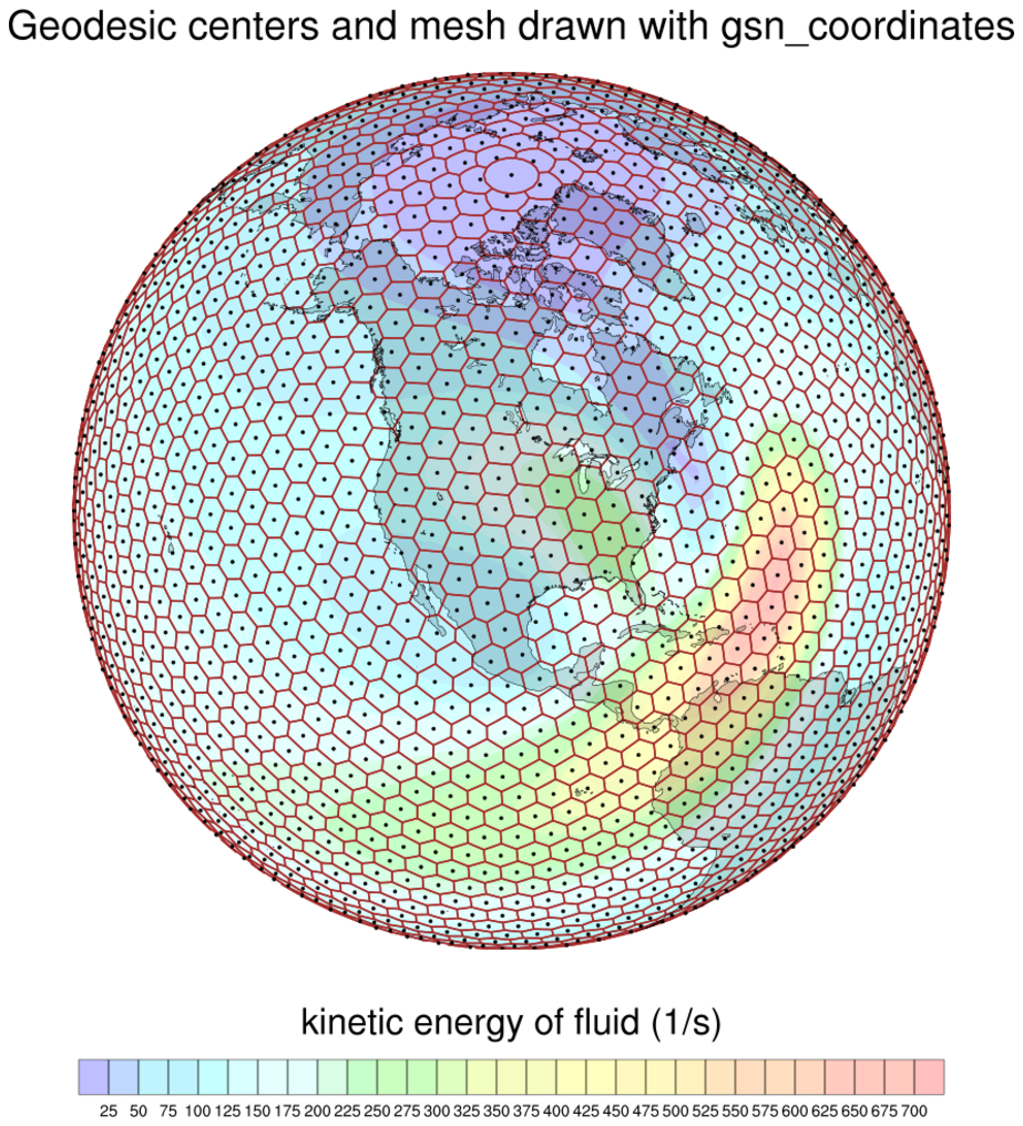
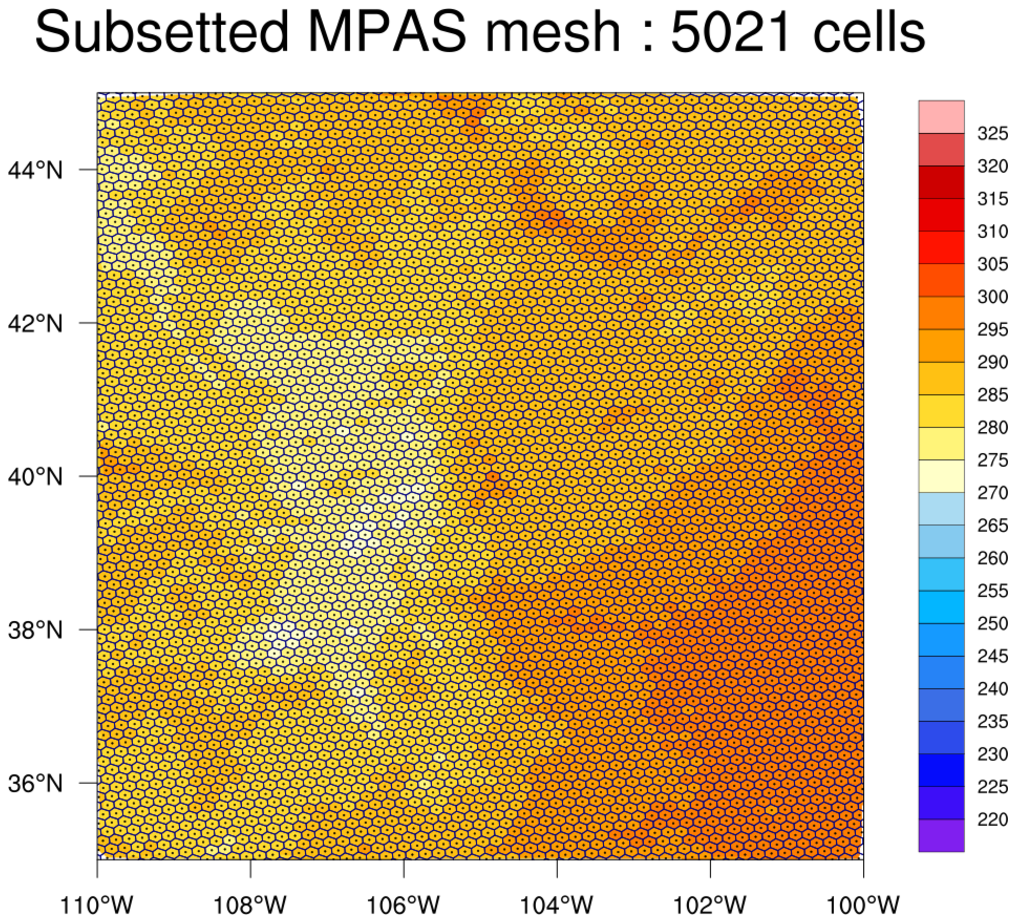
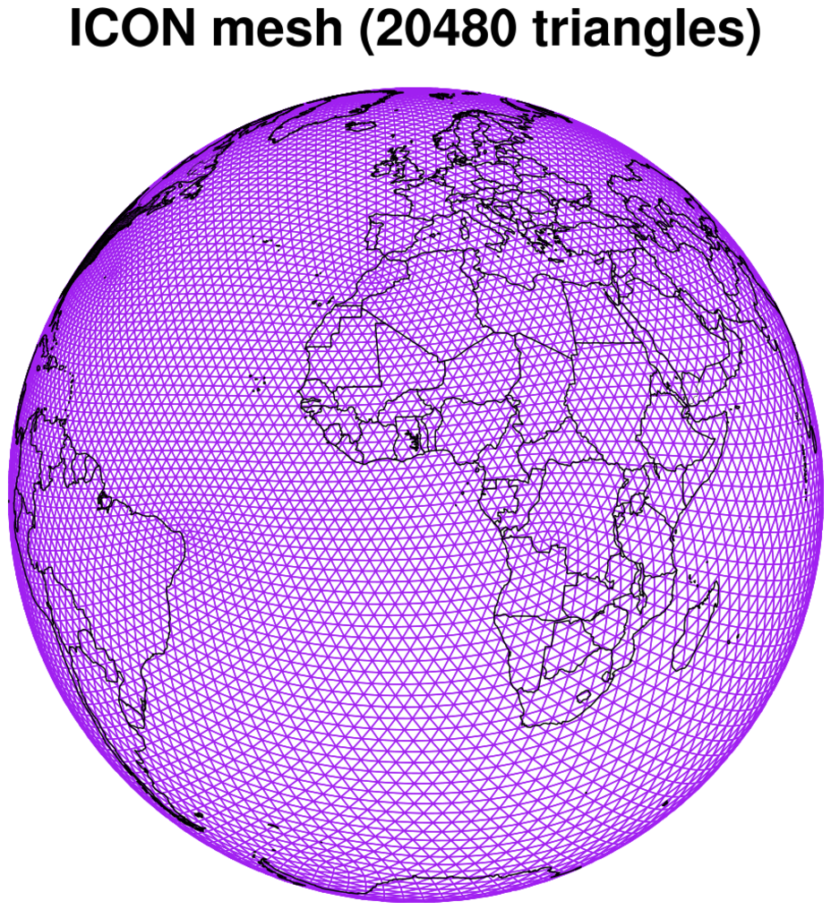
gsn_coordinates was updated to support the drawing of unstructured meshes (e.g. triangular meshes, hexagonal meshes).
| Geodesic geo_660_1.ncl | MPAS datagrid_9.ncl | ICON datagrid_10.ncl | ||
|---|---|---|---|---|
| 
| 
|
A new cividis color table was added. Click on image for larger view:

Bugs fixed
- gsn_panel - Fixed a bug in which
this procedure would fail if drawing a series of plots with
gsnPanelLabelBar set to True and the first plot didn't have a labelbar
but subsequent ones did. This has been fixed now such that one of the
subsequent plots will be used to generate the common labelbar.
- gsn_csm_contour_map (and related contour/map functions)
- Fixed bug in which filled contours were disappearing, in special
cases, near the boundary of some map projections. This happened
whenever the projection warped the points into a non-cartesian state
with the line of points not parallel to the y-axis.
- Fixed a bug where streaks would show up when contouring data on an
ICON grid over a Robinson projection.
- Fixed a bug where a contour plot of random data would not get drawn
if one or both axes were reversed.
- Fixed bug in which filled contours were disappearing, in special
cases, near the boundary of some map projections. This happened
whenever the projection warped the points into a non-cartesian state
with the line of points not parallel to the y-axis.
Deprecated WRF-ARW functions
The following WRF-ARW functions are deprecated in NCL V6.6.2. For backwards-compatibility, they will continue to work as documented.