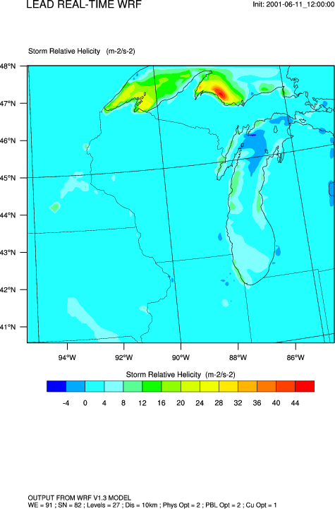
http://w1.spc.woc.noaa.gov/exper/mesoanalysis/help/help_srh1.html
In V5.2.0, the wrf_helicity function was added to calculate this quantity.
Example pages containing:
tips |
resources |
functions/procedures
http://w1.spc.woc.noaa.gov/exper/mesoanalysis/help/help_srh1.html
In V5.2.0, the wrf_helicity function was added to calculate this quantity.
wrf_helicity_1.ncl:
This script shows how to calculate helicity and create a smoothed
contour plot over a map.
Dr. Craig Mattocks of the Center for Environmental Modeling for Policy Development, UNC-Chapel Hill contributed this example.