The WRF variables in these examples are on a native polar stereographic projection. By default, when data are placed onto a map, NCL performs a transformation to the specified projection. This transformation is not needed for native grids. To turn off this default behavior, set tfDoNDCOverlay = True
The gsm_csm_map* suite of interfaces expect global data. To turn off this default mode, set gsnAddCyclic = False.
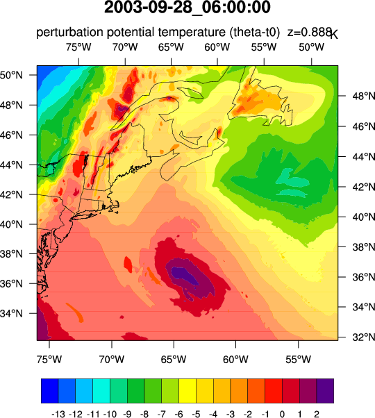
The WRF netCDF file contains the information needed to properly plot the grid, specifically: (i) the global attributes TRUELAT1, TRUELAT2 and CEN_LON and (ii) the grid latitudes (XLAT) and longitudes (XLONG). The required approach to plotting the data upon a native projection is to specify mpLimitMode = "Corners".