NCL > Application examples > Basic examples
ContourPlot example 17
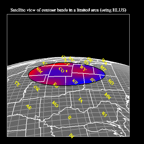
Drawing a restricted contour plot over a satellite view projection, and labelling the United States.
This example shows how to do a combination of things: restrict a contour plot to a certain area over a satellite projection, how to label the US states with AnnoManager, how to use NhlDataPoly{line,marker} to draw lines/markers on a map projection, and how to mix LLUs/HLUs to draw text in the map projection. The NCL version doesn't have the LLU/HLU part. The names of the example codes that create this plot are cn17c.c, cn17f.f, and cn17n.ncl.
Discussion
Some of the resources are controlled through a resource file called cn17.res.A detailed discussion about how to create the plot appears in the comments of the source code for the example.
Creating the plot using HLU C library calls
The HLU C program that generates this plot is called cn17c.c.
Creating the plot using HLU FORTRAN library calls
The HLU FORTRAN program that generates this plot is called cn17f.f.
Creating the plot using NCL
The NCL script that generates this plot is called cn17n.ncl. Please note that the NCL version only has one frame (the HLU C and FORTRAN versions have two frames) because you cannot call the LLUs from NCL.
The data
The dummy data for this plot is generated from within the program.
How to run this example
The examples are installed in the following locations:
- $NCARG_ROOT/lib/ncarg/hluex/contourplot/cn17c.c
- $NCARG_ROOT/lib/ncarg/hluex/contourplot/cn17f.f
- $NCARG_ROOT/lib/ncarg/nclex/contourplot/cn17n.ncl
- $NCARG_ROOT/lib/ncarg/resfiles/contourplot/cn17.res