NCL > Application examples > Basic examples
MapPlot example 6
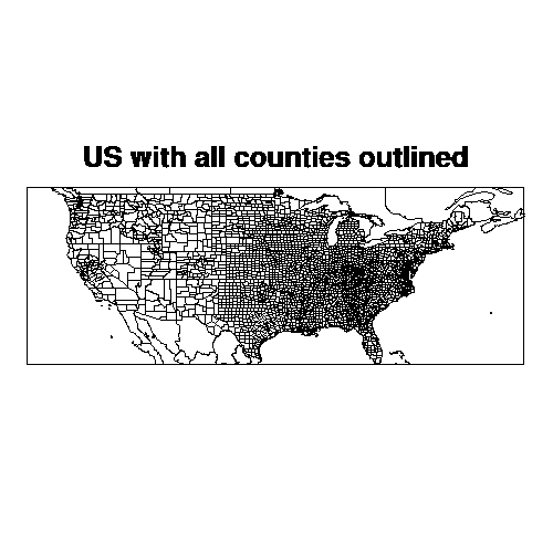
How to draw county lines in the mainland US
This map example was created using HLU C library calls, HLU FORTRAN library calls, and NCL. It demonstrates how to generate county lines in the United States using a different map database. The names of the source files for this example are mp06c.c, mp06f.f, and mp06n.ncl.
Discussion
This module discusses how to create this example using HLU function
calls and a resource file. The program demonstrates how to draw all
the county lines in the United States, how to draw just the counties
named "Adams", and how to draw all the counties in a particular state
(Florida in this case). Pay close attention to the resource file mp06.res, as it contains the
resources necessary for loading in the proper map database that
contains the county lines.A detailed discussion of how this example works appears in its source code.
Creating the plot using HLU C library calls
The HLU C program that generates this plot is called mp06c.c.
Creating the plot using HLU FORTRAN library calls
The HLU FORTRAN program that generates this plot is called mp06f.f.
Creating the plot using NCL
The NCL script that generates this plot is called mp06n.ncl.
The data
This plot does not use any external data.
How to run this example
The examples are installed in the following locations:
- $NCARG_ROOT/lib/ncarg/hluex/mapplot/mp06c.c
- $NCARG_ROOT/lib/ncarg/hluex/mapplot/mp06f.f
- $NCARG_ROOT/lib/ncarg/nclex/mapplot/mp06n.ncl