You should be able to substitute your own WRF-ARW data files in these scripts.
For more advanced WRF-ARW plotting scripts, visit:
You should be able to substitute your own WRF-ARW data files in these scripts.
For more advanced WRF-ARW plotting scripts, visit:
This example does not produce any graphics.
This example does not produce any graphics.
This example does not produce any graphics.
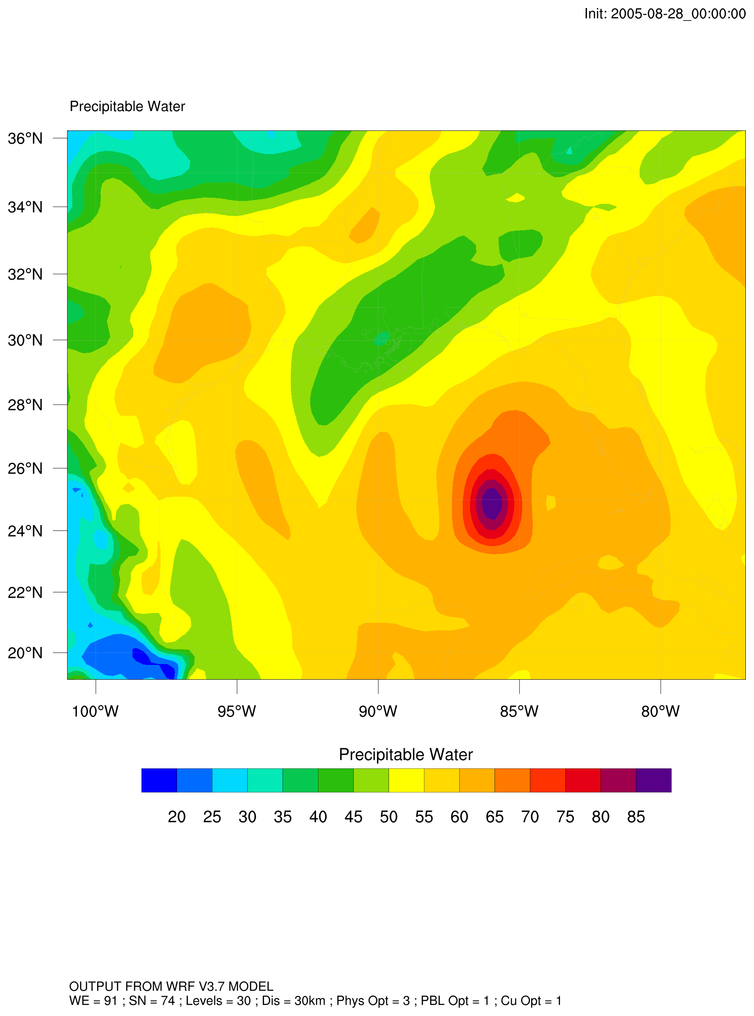
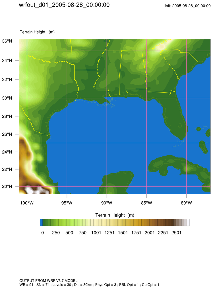
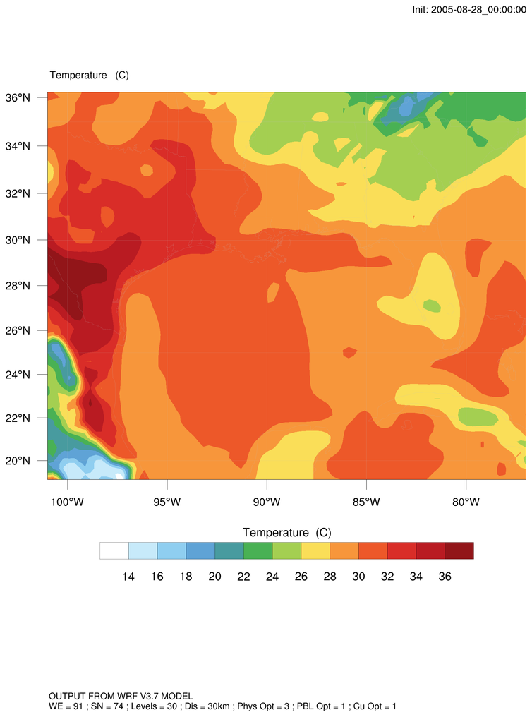
 wrf_demo_plot_var_simple.ncl:
Creates a basic plot of any one of the 2D wrf_user_getvar diagnostics.
wrf_demo_plot_var_simple.ncl:
Creates a basic plot of any one of the 2D wrf_user_getvar diagnostics.
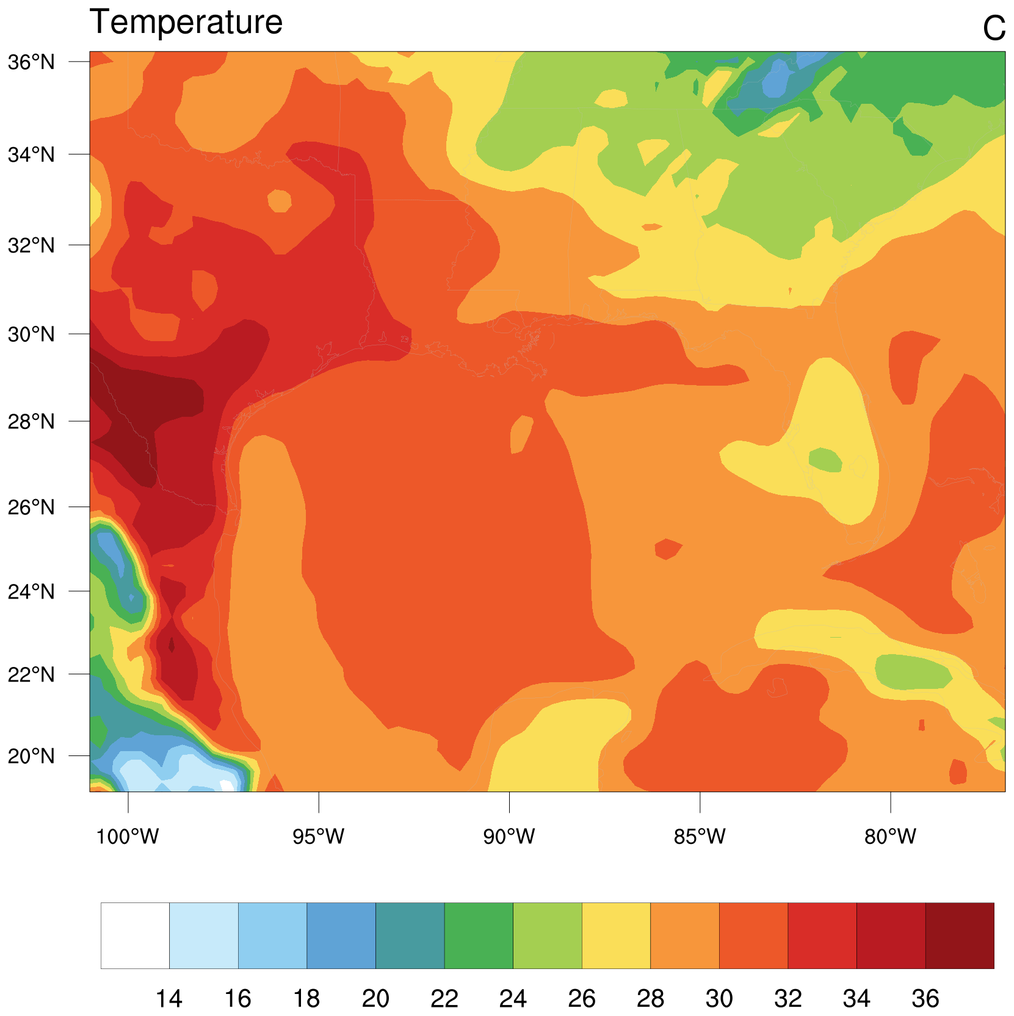
 wrf_demo_plot_var_advanced.ncl:
A more advanced script for plotting many of the wrf_user_getvar diagnostics.
wrf_demo_plot_var_advanced.ncl:
A more advanced script for plotting many of the wrf_user_getvar diagnostics.
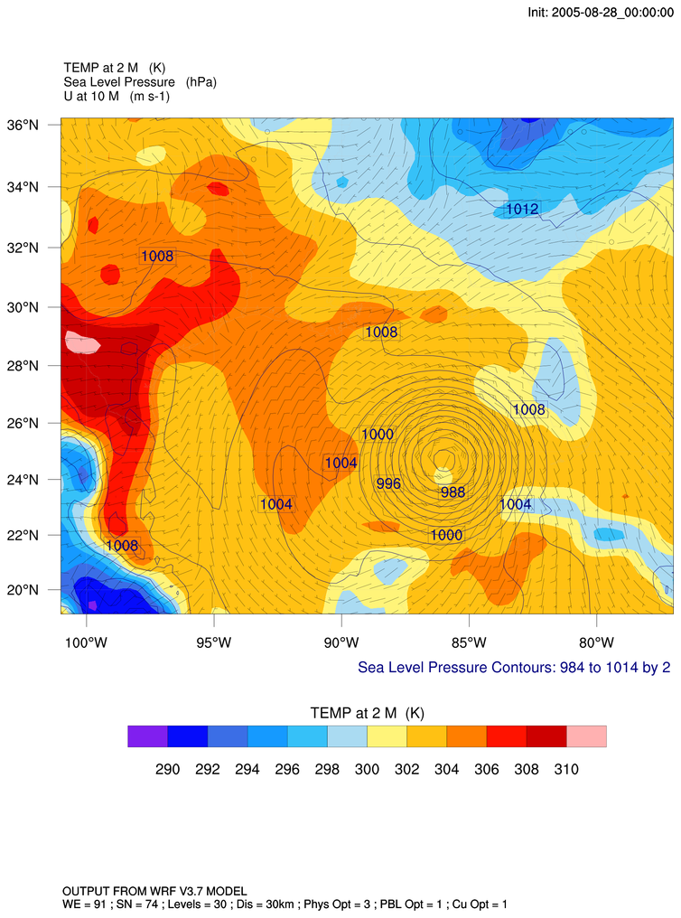
wrf_demo_plot_overlays.ncl:
Overlays line contours and wind barbs on top of a filled contour plot over a map.
 wrf_demo_plot_tc_gsn_minor_custom.ncl:
Creates a slightly more customized plot of temperature using gsn_csm.
wrf_demo_plot_tc_gsn_minor_custom.ncl:
Creates a slightly more customized plot of temperature using gsn_csm.
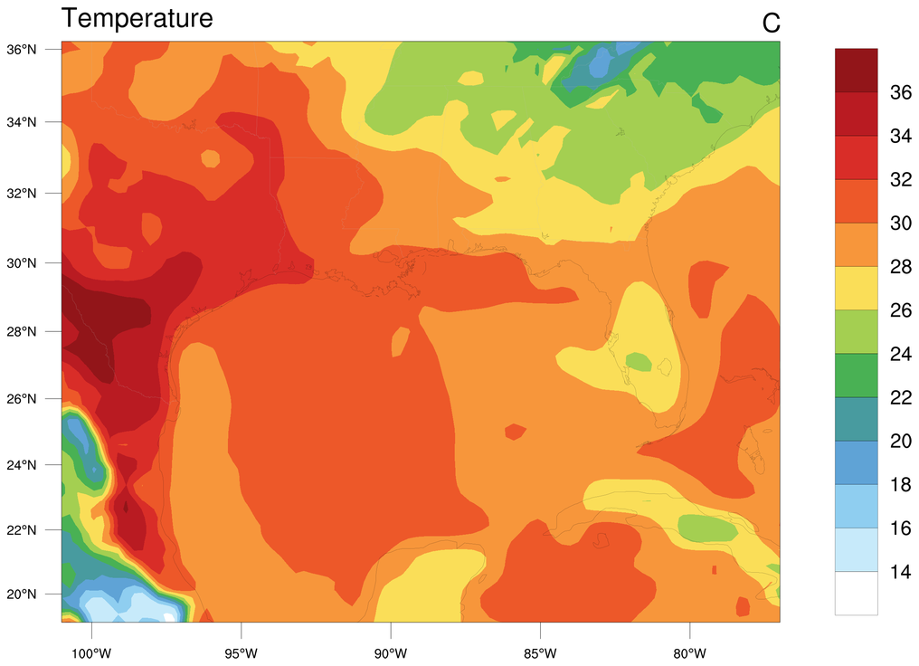
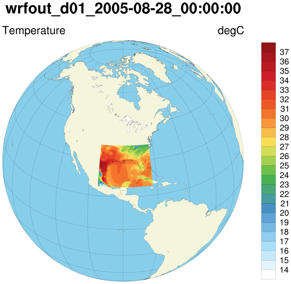
 wrf_demo_plot_tc_gsn_nn.ncl:
Creates a basic plot of temperature over a non-native map projection using gsn_csm
wrf_demo_plot_tc_gsn_nn.ncl:
Creates a basic plot of temperature over a non-native map projection using gsn_csm
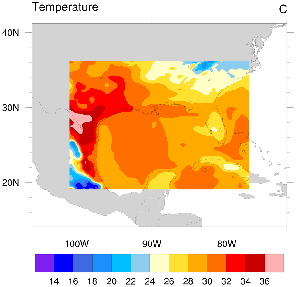
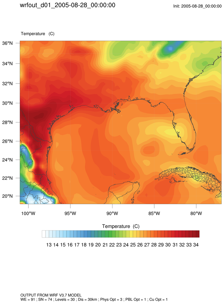
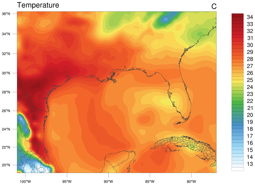
 wrf_demo_plot_tc_gsn_major_custom.ncl:
Creates a more customized plot of temperature over a satellite map projection using gsn_csm.
wrf_demo_plot_tc_gsn_major_custom.ncl:
Creates a more customized plot of temperature over a satellite map projection using gsn_csm.
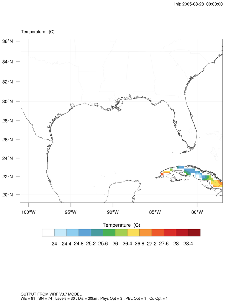 wrf_demo_plot_tc_shapefiles_mask.ncl:
Masks data based on a shapefile outline using WRF-NCL. Depends on shapefile_utils.ncl.
wrf_demo_plot_tc_shapefiles_mask.ncl:
Masks data based on a shapefile outline using WRF-NCL. Depends on shapefile_utils.ncl.
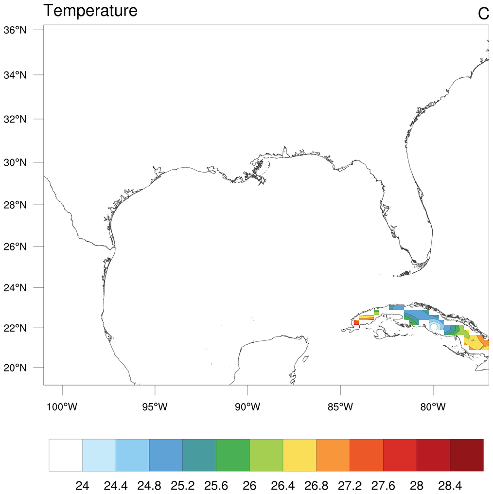 wrf_demo_plot_tc_gsn_shapefiles_mask.ncl:
Masks data based on a shapefile outline using gsn_csm. Depends on shapefile_utils.ncl.
wrf_demo_plot_tc_gsn_shapefiles_mask.ncl:
Masks data based on a shapefile outline using gsn_csm. Depends on shapefile_utils.ncl.
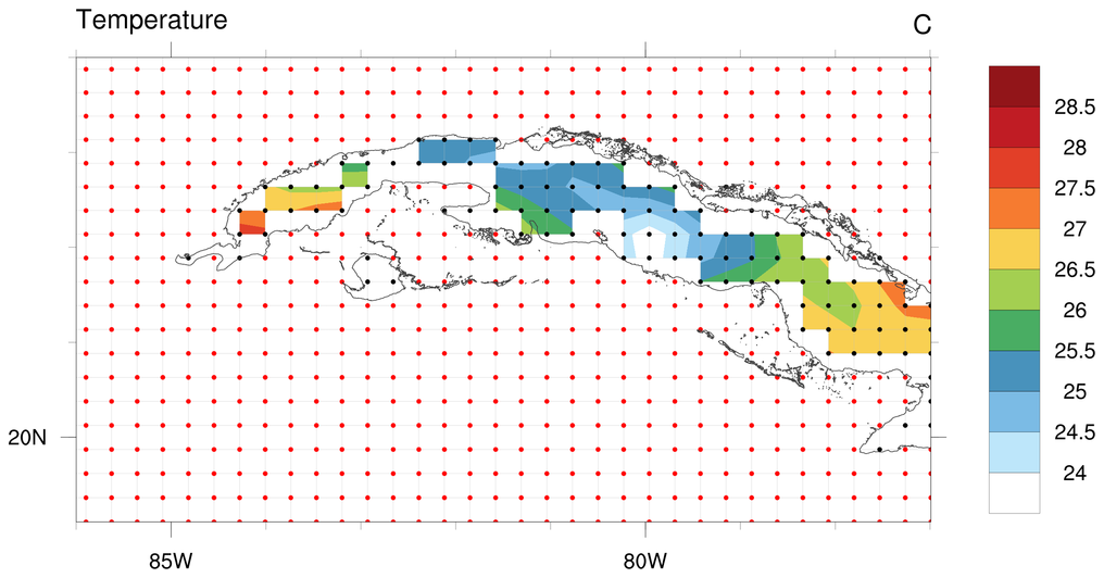 wrf_demo_plot_tc_gsn_shapefiles_mask_zoom.ncl:
Zooms in on masked shapefile data using gsn_csm. Depends on shapefile_utils.ncl.
wrf_demo_plot_tc_gsn_shapefiles_mask_zoom.ncl:
Zooms in on masked shapefile data using gsn_csm. Depends on shapefile_utils.ncl.
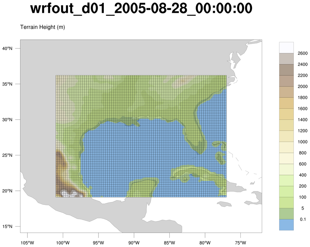
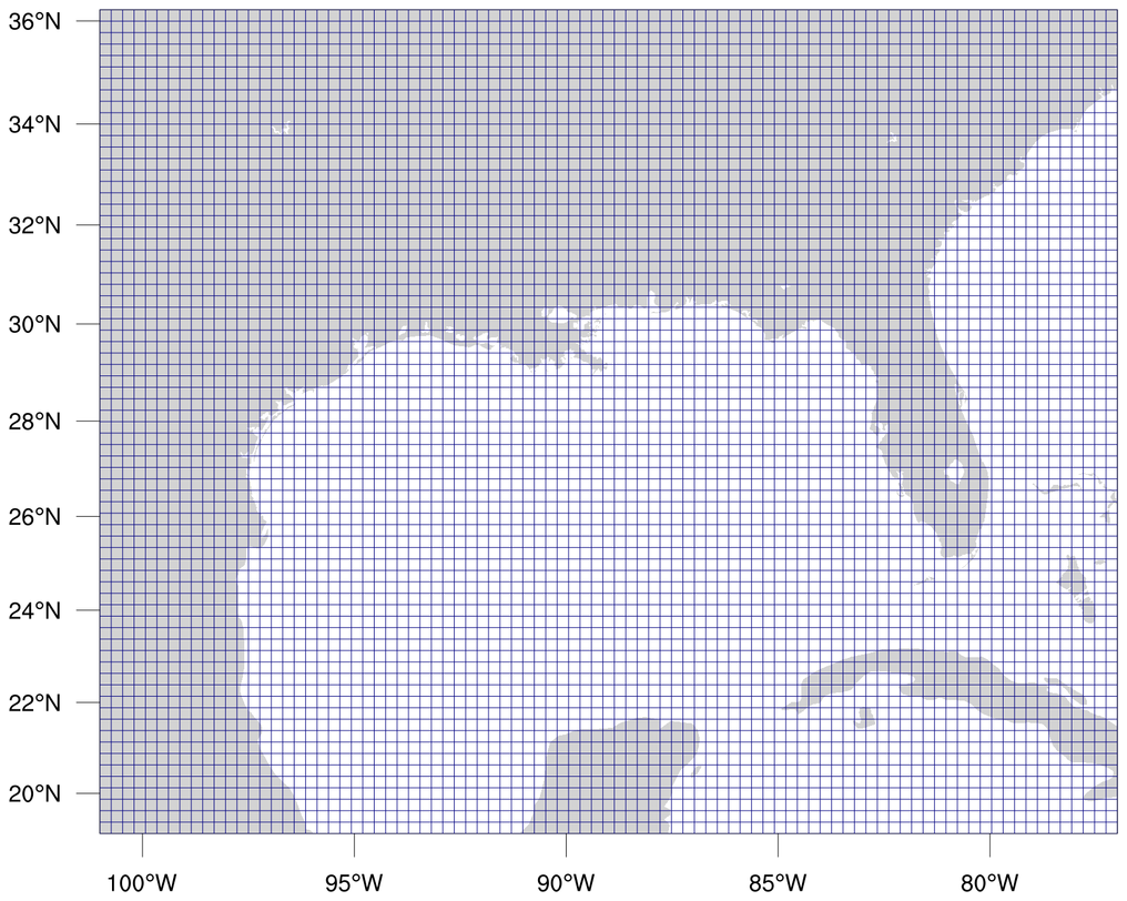
 wrf_demo_plot_hgt_coordinates.ncl:
Adds lines outlining the lat/lon WRF grid on top of HGT contours (WRF-NCL).
wrf_demo_plot_hgt_coordinates.ncl:
Adds lines outlining the lat/lon WRF grid on top of HGT contours (WRF-NCL).
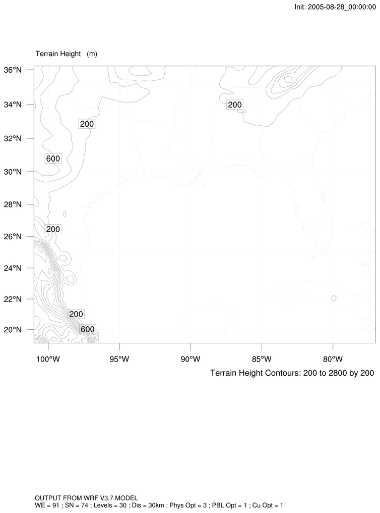
 wrf_demo_plot_hgt_gsn_coordinates.ncl:
Adds lines outlining the lat/lon WRF grid on top of HGT contours (gsn_csm).
wrf_demo_plot_hgt_gsn_coordinates.ncl:
Adds lines outlining the lat/lon WRF grid on top of HGT contours (gsn_csm).
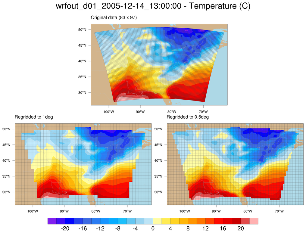 wrf_demo_tc_regrid_gsn.ncl:
Regrids data on a WRF grid to two different rectilinear grids (gsn_csm).
wrf_demo_tc_regrid_gsn.ncl:
Regrids data on a WRF grid to two different rectilinear grids (gsn_csm).