The scripts below work with either NetCDF or GRIB files. For them to work correctly with GRIB, however, you need to set the NCL_GRIB_PTABLE_PATH environment variable to point to the location of the "gt" directory, which contains the appropriate grib tables:
  setenv NCL_GRIB_PTABLE_PATH `pwd`/gt
or
  export NCL_GRIB_PTABLE_PATH=`pwd`/gt
The "gt" files are available as a tar file.
All scripts below are provided in two versions. The plain version "cosmo_n.ncl" will work with your plain NCL installation. The "cosmolib_n.ncl" scripts mentioned below are based on a library of additional NCL scripts called "COSMOlib", which hide some of the complexity of handling both GRIB and NetCDF.
For more information about COSMOlib and to download it, visit:
https://wiki.c2sm.ethz.ch/Wiki/VisNCLCosmoLibrary
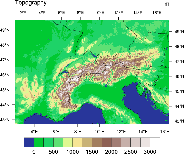
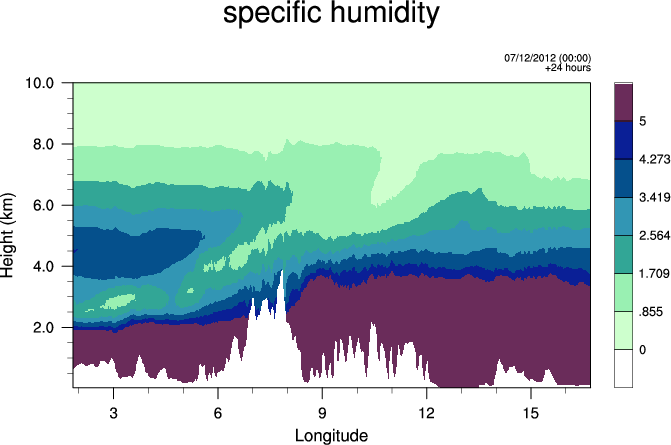
MeteoSwiss uses a suite of color tables that they've developed and contributed to the NCL project.