The interpolation coefficients used to interpolate from POP grids to lat/lon grids strictly apply to the surface only. The coefficients were developed so that the ocean and atmosphere models could communicate flux information. The topography reflects the surface only. If you try and plot a level deeper than the surface, you may get errors around boundaries (continents) since the surface topography is not necessarily applicable with depth. If you wish to plot a layer other than the surface, it may be possible to run SCRIP with a different topography file. We are not aware of anyone who has done this however, and do not know the procedures.
NCL Home>
Application examples>
Models ||
Data files for some examples
lat2pop_1.ncl:
lat2pop_2.ncl:
Example pages containing:
tips |
resources |
functions/procedures
NCL: Lat/Lon Grid to POP Grid
The interpolation of variables on POP grids to rectilinear
lat/lon grids and rectilinear lat/lon grids to POP grids is limited by the
existence of appropriate regrid weight files. See
the POP weight files page for more
details.
The following libraries must be loaded for grid interpolation:
    load "$NCARG_ROOT/lib/ncarg/nclscripts/csm/contributed.ncl"
    load "$NCARG_ROOT/lib/ncarg/nclscripts/csm/popRemap.ncl"
lat2pop_1.ncl:
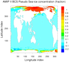
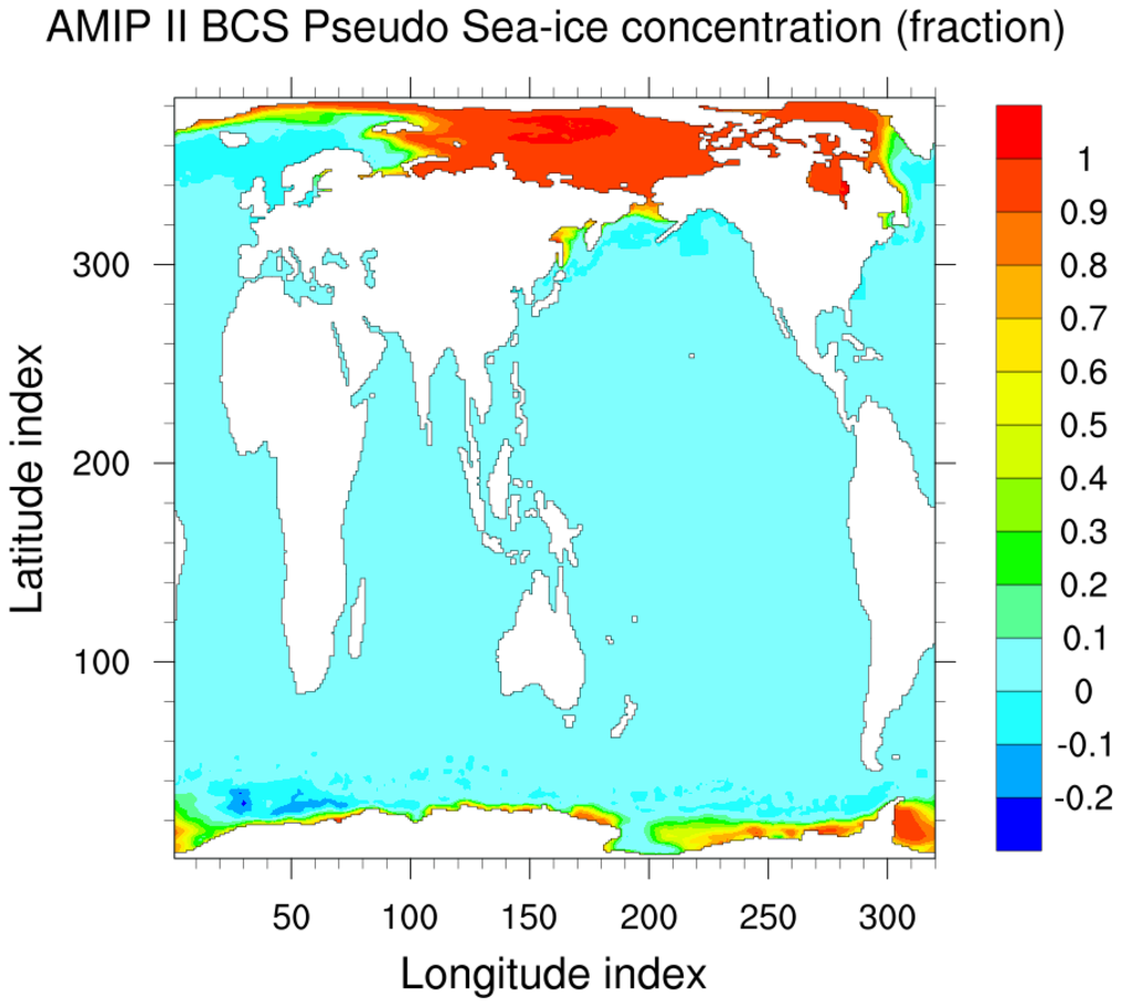
Uses PopLatLon to convert a lat/lon grid to the pop grid.
The arguments are:
- variable e.g. "ice"
- original grid name e.g. "1x1"
- output grid name e.g. "gv3"
- weight method e.g. "bilin" or "aave" for bilinear or area averaged
- type of weights e.g. "da", for destarea, or "fa"
- time on grid file
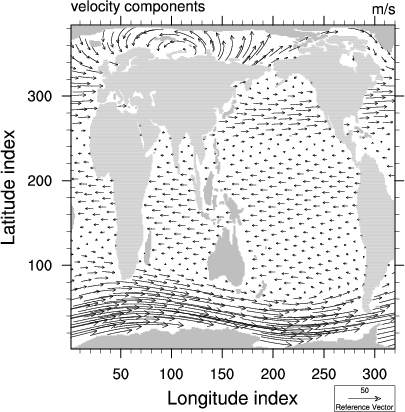
lat2pop_2.ncl:
Uses PopLatLonV to convert a lat/lon grid to the pop grid.
The arguments are:
- variables e.g. "u,v"
- original grid name e.g. "T42"
- output grid name e.g. "gx1v3"
- weight method e.g. "bilin" or "aave" for bilinear or area averaged
- type of weights e.g. "da", for destarea, or "fa"
- time on grid file