gsn_add_polygon
Attaches a filled polygon to the given plot.
Prototype
load "$NCARG_ROOT/lib/ncarg/nclscripts/csm/gsn_code.ncl"  ; This library is automatically loaded
                                                          ; from NCL V6.2.0 onward.
                                                          ; No need for user to explicitly load.

	function gsn_add_polygon (
		wks  [1] : graphic,
		plot [1] : graphic,
		x    [*] : numeric,
		y    [*] : numeric,
		res  [1] : logical
	)

	return_val [1] :  graphic
Arguments
wksA Workstation identifier. The identifier is one returned either from calling gsn_open_wks or calling create to create a Workstation object.
plotA plot identifier created by using one of the many gsn functions, or by calling create to create a View object.
xy
One-dimensional arrays of the same length containing the X and Y coordinates of the polygon, and must be in the range of the X/Y coordinates of the data in plot. If you are adding the polygon to a map, then X should correspond to longitude values, and Y to latitude values.
resA variable containing an optional list of polygon resources, attached as attributes. Set to True if you want the attached attributes to be applied, and False if you either don't have any resources to set, or you don't want the resources applied.
Return value
A scalar representing the id of the polygon attached will be returned. If you call any of the gsn_add_polygon, gsn_add_polyline, or gsn_add_polymarker functions in the same NCL script, you must assign each of their return values to a unique variable name. There's more information on this below in the examples section.
Description
This function creates and attaches a polygon to the given plot. If a missing value is encountered in x and/or y, then this pair is ignored, but the polygon will still be closed.
This function only attaches the polygon to the plot. Hence, you can only see the polygon when you call draw on the plot you attached it to.
If you are attaching text to a plot and not seeing it on the plot, then you may want to check the draw order of the various elements of your plot. For example, if you are attaching the text to a map and you have mpFillDrawOrder set to "PostDraw", then this may cause your text to be hidden behind the map fill. You can also try specifying the draw order of the text itself, relative to elements of the plot you're attaching it to. The resource for this is tfPolyDrawOrder, and it can be set to one of "PreDraw", "Draw", or "PostDraw" (the default is "PostDraw"). See example 2 below.
The value returned from this function must be assigned to a unique variable. This is necessary so that the polygons "live" for the duration of the NCL script. This is especially imperative if the call to gsn_add_polygon is inside a function or procedure. Please see examples 1 and 2 in the examples section in the gsn_add_polyline documentation for more information.
There are many
If you resize the plot (i.e., by passing the plot to gsn_panel or setting the vpWidthF or vpHeightF resources), then the polygon will be
automatically resized with the plot.
Note: there is a potential incompatible change
in NCL version 6.2.0, when
attaching lines or polygons to a map. This change
affects gsn_polyline,
gsn_add_polyline,
gsn_polygon,
and gsn_add_polygon.
Previously, drawing a polyline around the equator, for example, could
be specified using 2-element arrays. For example:
lnid = gsn_add_polyline(wks,map,(/0,360/),(/0,0/),lnres)
Now, however, in order to eliminate a number of ambiguous situations
and to make user code simpler in most cases, a new behavior has been
introduced: the line between two points on the globe always follows
the shortest path. In the example above, the behavior in NCL V6.2.0
leads to a 0-length line. The recommended approach now for drawing a
line around the equator is to use four points, such that the distance
from one to the next is always less than 180 degrees. For example:
lnid = gsn_add_polyline(wks,map,(/0,120,240,360/),(/0,0,0,0/),lnres)
See Also
gsn_polygon, gsn_polymarker, gsn_polyline, gsn_polygon_ndc, gsn_polymarker_ndc, gsn_polyline_ndc, gsn_add_polygon, gsn_add_polymarker, gsn_add_polyline, gsn_text, gsn_text_ndc, gsn_add_text, gsn_add_shapefile_polymarkers, gsn_add_shapefile_polygons, gsn_add_shapefile_polylines, NhlNewMarker, NhlNewDashPattern
Examples
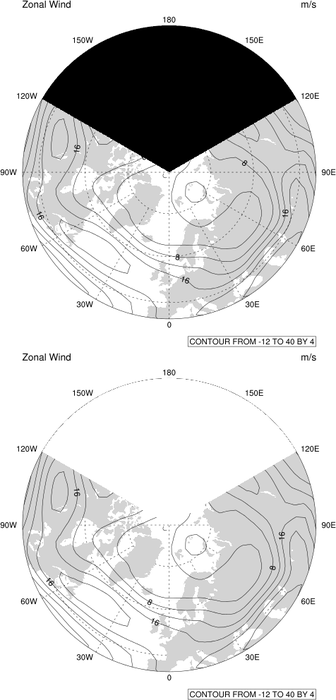
For some application examples, see the polygon examples, or see "polar_5.ncl" (view example).
Example 1
This example uses the three functions gsn_add_polyline, gsn_add_polygon, and gsn_add_polymarker to add some primitives to an XY plot.
Note that each call to a gsn_add_xxxx function is assigned to a unique
variable. This is necessary in order to ensure that the
polylines/markers/gons "live" for the entire NCL script. If the calls to
these functions reside in an NCL function or procedure, then
additional steps must be taken to make sure the polylines/markers/gons
"live" outside of the function or procedure. For information on this,
see examples 1 and 2 in the
Example 2
Try uncommenting the setting of the tfPolyDrawOrder resource below, and watch
how this changes the order of when the yellow box is drawn with
respect to the map outlines, map fill, and contour lines. You can also
play with the cnLineDrawOrder and
mpOutlineDrawOrder resources to
further control the draw order of individual plot elements.
load "$NCARG_ROOT/lib/ncarg/nclscripts/csm/gsn_code.ncl"

begin
;
; Create workstation.
;
  wks = gsn_open_wks("ncgm","add_primitive")

;
; Create a data object.
;
  npts = 500
  x    = fspan(0,npts-1,npts)
  y    = 500.+ 0.9 * x * sin(0.031415926535898*x)

  xyres = True
  xyres@gsnMaximize = True
  xy = gsn_y(wks,y,xyres)

;
; Create data for primitives.
;
  plx = x
  ply = 500. + 0.5 * x * sin(0.031415926535898*x)
  pgx = (/ 100., 200., 200., 100., 100. /)
  pgy = (/ 200., 200., 300., 300., 200. /)
  pmx = (/ 200., 150., 200., 250. /)
  pmy = (/ 900., 800., 700., 800. /)

;
; Set up three separate resource lists, although we could have
; used the same one here.
;
  pmres                  = True
  plres                  = True
  pgres                  = True
  plres@gsLineColor      = "orange"
  plres@gsLineThicknessF = 2.0
  pgres@gsFillColor      = "Navy"
  pmres@gsMarkerIndex    = 12
  pmres@gsMarkerSizeF    = 0.02
  pmres@gsMarkerColor    = "yellow"

;
; Make sure each variable name is unique.
;
  dum1 = gsn_add_polyline  (wks, xy, plx, ply, plres)
  dum2 = gsn_add_polygon   (wks, xy, pgx, pgy, pgres)
  dum3 = gsn_add_polymarker(wks, xy, pmx, pmy, pmres)

  draw(xy)
  frame(wks)

;
; Resize the plot and draw in the middle of the frame, and
; see how the primitives automatically get adjusted as well.
;
  setvalues xy
    "vpXF"        : 0.3
    "vpYF"        : 0.7
    "vpWidthF"    : 0.4
    "vpHeightF"   : 0.4
  end setvalues

  draw(xy)
  frame(wks)
end
load "$NCARG_ROOT/lib/ncarg/nclscripts/csm/gsn_code.ncl"
load "$NCARG_ROOT/lib/ncarg/nclscripts/csm/gsn_csm.ncl"

begin
;
; Open a netCDF file and read some data.
;
  a   = addfile("$NCARG_ROOT/lib/ncarg/data/cdf/meccatemp.cdf","r")
  t   = a->t(0,:,:)                     ; Read first time step

  wks = gsn_open_wks("x11","draw_order")

  res                      = True

  res@gsnDraw              = False
  res@gsnFrame             = False

  res@gsnMaximize          = True
  res@gsnAddCyclic          = False   ; Don't add longitude cyclic pt.

  res@mpOutlineOn          = True

;  res@cnLineDrawOrder      = "Draw"  ; These resources can be one of
;  res@cnFillDrawOrder       = "Draw"  ; "PreDraw", "Draw" or "PostDraw".
;  res@mpOutlineDrawOrder   = "Draw"
;  res@mpFillDrawOrder      = "PreDraw"

  plot = gsn_csm_contour_map(wks,t,res)

  gres                 = True
  gres@gsFillColor     = "yellow"
;  gres@tfPolyDrawOrder = "Draw"  ; this can be used for polylines, polymarkers, or polygons

  lat = (/-25,  35, 35, -25, -25/)
  lon = (/-45, -45,  5,   5, -45/)
  dum = gsn_add_polygon(wks,plot,lon,lat,gres)

  draw(plot)
  frame(wks)
end