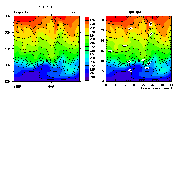
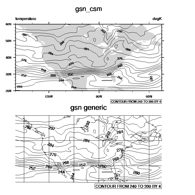
Difference between gsn generic and gsn_csm interfaces
The gsn_csm interfaces create more customized visualizations than the gsn generic interfaces, and, where possible, metadata is used for automatic labeling and coordinate information.Some of the gsn_csm customizations include:
- latitude/longitude tickmark labels for geo-referenced data
- grey-filled land masses in map plots
- axes labels and titles based on metadata
- labelbar for filled contour and vector plots
- special labels for polar stereographic plots
- outward-pointing tickmarks
compare gsn_csm and gsn generic (contours over maps)